Join us for the Graduate GIS Programs Information Session May 7 at 12 p.m. PT Register Today
USC Dornsife Spatial Sciences Institute

Author Archives: actemplatestg

  1. How GIS Has Evolved in the Digital Age

    Comments Off on How GIS Has Evolved in the Digital Age

    Digital cartography and GIS have had an impactful history in developing our understanding of the world; as GPS World editor Janice Partyka noted, some of the first digital maps were created by the U.S. Census Bureau, which used GIS and digital mapping to better understand population trends within specific Census tracts.
    how gis has evolved in the digital age
    While these developments happened in the 1960s, the Bureau’s work helped to showcase the transformative power of digital cartography in relation to GIS; this helped set the foundation for greater government investment and evolution in the technology that makes digital mapping possible. Since then, popular consumer-facing services like Google Maps have contributed considerably to the advancement of GIS and digital mapping.

    Given that it has been more than a decade since Google Maps first launched, we thought it would be interesting to look at how GIS is used in digital mapping today and discuss what we can expect for the future.

    Related Content: Top GIS Technologies in 2018 & Beyond

    Request Brochure

    Fill out the information below to learn more about the University of Southern California’s GIS Graduate Programs and download a free brochure. If you have any additional questions, please call 213-325-2474 to speak to an enrollment specialist.

    University of Southern California has engaged AllCampus to help support your educational journey. AllCampus will contact you shortly in response to your request for information. About AllCampus. Privacy Policy. You may opt out of receiving communications at any time.

    * All Fields are Required. Your Privacy is Protected.

    How GIS is used in Digital Mapping Today

    There are countless factors contributing to the evolution of digital mapping and GIS, ranging from increasingly sophisticated geospatial analytics software to market demand for technology, such as smart vehicles, that require unprecedented levels of accuracy. Below are our top four trends in digital cartography and GIS as well as what they may mean for the geographic information science and technology.

    1. GIS Technology and Open Source Mapping

    One of the most significant contributions of digital mapping to the world of GIS is the speed at which we can update information. For example, open source mapping and geospatial data projects enable anyone with GIS knowledge to create maps, share information and develop insights that can be readily used by people who need them. When combined with technology such as drones and advanced image recognition software, crowdsourced data becomes more easily verifiable and can be supplemented with detailed imagery.

    One of the challenges crowdsourced spatial data helps address is the frequency of updating in response to factors such as dynamic social boundaries and geography changes due to disasters or military conflicts.

    However, one of the ongoing challenges with open source mapping is the variety of data. Even when considering geospatial information sourced from government agencies, there has historically been a lack of standardization in the formatting of data and how mapped entities are referenced, making it difficult to create a unified view of the truth. This challenge has contributed to a renewed focus on data quality from organizations that are committed to creating open geospatial data communities. As the Open Data Institute noted, for example, organizations such as MapBox have created quality control tools for assessing the validity of a large volume of map changes — approximately 80,000 each day.

    2. Image Recognition Becomes a Critical Area for GIS

    Advancing image recognition software is a top priority for numerous giants in digital mapping, including Google, HERE Technologies as well as cloud computing leaders like Amazon Web Services. For the past several years, machine learning algorithms have taken center stage for image recognition, due to an unprecedented degree of accuracy. For example, facial recognition research published in 2018 found that algorithms were capable of accuracy that matches professionally trained facial; more interesting, though is that the future appears to be a cooperation between humans and AI—the most accurate results came from humans who were aided by the advanced image recognition algorithm.

    One of the current areas of interest for image recognition in conjunction with GIS and digital mapping is the potential for automatically creating structured spatial data just by taking pictures. This would have significant implications for countless GIS applications, including autonomous vehicles, consumer mapping applications, mobile GIS software and geospatial intelligence. As an example of this in practice, Microsoft released 125 million building footprints in the form of open data in June 2018, which was possible due to the company’s investment in deep learning, computer vision and artificial intelligence.

    The advancement of image recognition and its integration with structured spatial data will ultimately lead to more accurate digital maps, since data updates will be less reliant on manual data entry and less prone to user error.

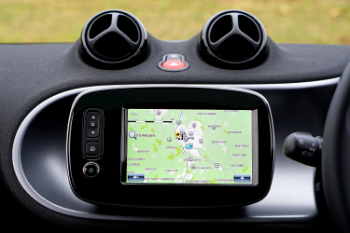
    3. Web Mapping Tools Pave the Way for User-Friendly, Interactive Maps

    One of the significant benefits of expanding usage of GIS for industry and consumer applications is the rise of leveraging web tools for building maps. The same qualities that make script libraries like jQuery, markup languages like HTML5 and programming languages JavaScript beneficial for building other web apps make them great for digital mapping and GIS; these tools make it easier for GIS developers to build interactivity into their maps and make the information more easily digestible for people who need it.

    Related Content: 4 Historical GIS Projects that You Don’t Know About

    For example, imagine you wanted to compare the geography, political boundaries and communities of a specific region over several centuries. Web design tools make it relatively easy to create a map with a slider bar tool and filters to watch the evolution of the region over time. Using printed maps, you might have had to look at dozens, if not hundreds, of maps to get the complete picture.

    4. Spatial Data Processing and “Edge” Computing for Digital Mapping

    One of the broader technology trends that has significant implications for digital cartography and GIS is “edge” computing. While definitions of what edge computing actually is vary, the common theme behind it is the push toward processing at the edges of communications networks.

    For example, think about an autonomous vehicle and the challenges that might be involved in processing large volumes of spatial data. If an autonomous vehicle must capture and send geospatial data into the cloud for processing, any disruption in communication or latency in the network could result in a serious accident. In world with edge computing, the vehicle itself would capture, process and analyze the data, lowering risks caused by latency and signal disruptions.

    In addition to smarter vehicles, security and urban planning represent key areas of interest for edge computing and GIS.

    Video data from large surveillance systems, for example, could be better leveraged to make urban planning and security decisions. One of the common ways to process this data now is to send it a central system that is composed of GPU-accelerated clusters. However, this method is both energy and time-intensive. Research into more efficient algorithms suggests efficiency of processing video data may be improved by a factor of 10, reducing both the energy used and the time it takes to translate raw data into actionable information. This would also help in the creation of software that could do the analyzing within the cameras themselves, instead of relying on transmitting large volumes of data back and forth.

    With faster processing and more devices capable of extracting meaning from video data, digital maps can be made that automatically update in real time, and better showcase spatial-temporal elements such as population density at specific times of day or typical patterns of foot and vehicle traffic. This information could then be used to better plan road systems, develop safer evacuation plans or more strategically allocate emergency responders during a disaster.


    About USC’s GIS Graduate Programs

    The University of Southern California offers a comprehensive selection of online and residential GIS programs. This includes both GIS master’s degrees and GIS graduate certificates. Click on the programs below to learn about our leading geographic information science education.

    GIS Master’s Degrees

    GIS Graduate Certificates

  2. How Mapping Is Used by NASA & Applications of GIS in Space

    Comments Off on How Mapping Is Used by NASA & Applications of GIS in Space

    When we think of the tools involved in exploring outer space, images of astronauts collecting mineral samples on the moon may come to mind. However, scientists also depend on more remote methods to deepen our knowledge of the solar system and the universe beyond, like those offered by geographic information science (GIS). GIS space exploration has become a crucial part of how NASA gets to know the features of other worlds, develops our broader understanding of geophysics and gathers valuable information about our own planet.

    The wide array of GIS uses and applications include enormous possibilities for applying spatial data to make discoveries and solve problems. Geographic Information Science and Technology (GIST) enables powerful insights into the development of urban cities, the geography of forests and even phenomena throughout the observable universe. With skilled experts at NASA and other organizations guiding GIST strategies and software, we can continue to learn more about our planet and the universe.


    Exploring Mars with Spatial Thinking

    Getting to know the planets and objects in our solar system requires advanced systems for observation and extensive analysis. The more information that researchers have concerning the features of these surfaces, the better we can understand their origins and how they have changed over time. Advances in GIS technology enable more accurate mapping of planets and other celestial bodies than ever before possible, turning the data and images that satellites and rovers send back into a wealth of spatial information.
    gis applications in urban planning
    Although no astronaut has yet set foot on Martian soil, scientists have become highly familiar with the terrain’s features, thanks in large part to GIS. 2001 Mars Odyssey, the robotic spacecraft that has orbited Mars since October of that year, provides spatial data on the planet’s surface. As part of its mission to explore the red planet and locate any signs that it may have once supported life, the orbiter collects geological details and transmits images of surface minerals for more extensive analysis.

    To accomplish these objectives, NASA equipped the Odyssey with a camera called the Thermal Emission Imaging System (THEMIS). This system maps the surface, both capturing images in the visible spectrum and detecting thermal energy in wavelengths that are undetectable by the human eye. As a result, scientists were able to generate a detailed model of the planet, learning about many different types of rocks found there and the effects of tectonic activity on the surface. By applying GIS techniques to the details that NASA has collected, experts can find the most productive paths for Mars rovers and potentially a future manned mission.

    Request Brochure

    Fill out the information below to learn more about the University of Southern California’s GIS Graduate Programs and download a free brochure. If you have any additional questions, please call 213-325-2474 to speak to an enrollment specialist.

    University of Southern California has engaged AllCampus to help support your educational journey. AllCampus will contact you shortly in response to your request for information. About AllCampus. Privacy Policy. You may opt out of receiving communications at any time.

    * All Fields are Required. Your Privacy is Protected.

    Venturing to the Edge of the Solar System

    NASA further enhanced our perspective on the solar system through the New Horizons mission launched in January 2006. The probe visited Jupiter before carrying on toward the solar system’s outskirts, where it completed its primary mission of observing Pluto in 2015. The Long-Range Reconnaissance Imager (LORRI) and the Multispectral Visible Imaging Camera (MVIC) onboard garnered an unprecedented close-up look at the dwarf planet and its moons before the probe moved on to examine more of the Kuiper Belt, a massive collection of icy objects with a history that traces back to the formation of the solar system.

    Planetary maps and mosaics generated from the spatial information gathered from these efforts build our understanding of the geology, topology and geography of distant objects in space. The U.S. Geological Survey’s Astrogeology Science Center offers access to the images and data collected by various missions, including New Horizons, for use by researchers and the public. The database features visuals from our moon, Mars, Pluto, Saturn, Mercury and more, with the compatibility to use GIS software for further analysis.


    Mapping from Space to Solve Problems on Earth

    NASA’s organizational goals are not restricted to answering questions about space. The agency also channels its technology and expertise to confront pressing issues here on Earth, and GIS has an important role to play in several of these initiatives. GIS analysts at NASA may be tasked with projects such as:

    • Model the effects of climate change
    • Track the spread of contagious diseases
    • Monitor populations and habitats of endangered species
    • Provide information about water resources and risks of flooding to vulnerable regions

    The GIS team at NASA Langley Research Center uses spatial data to perform surveys and measure flood impact, locating flooded buildings and drawing historical comparisons. They also work toward helping the agency function more efficiently and responsibly. GIS tools reveal how to utilize the available area in facilities more effectively and assist in planning relocations. The team continues to create tools for monitoring the construction and maintenance of buildings, as well as managing cultural resources on the grounds of NASA centers.

    For those who want to use GIS mapping in their own research, the NASA Center for Climate Simulation released a Spatial Analytics Platform. Some of the applications for this tool’s analytics and data management capabilities include:

    • Compare results for areas included in the U.S. Census
    • Find topographic details for cities around the world
    • Locate hazards like landslides with key statistics
    • Perform geometry operations

    About USC’s GIS Graduate Programs

    The University of Southern California offers a comprehensive selection of online and residential GIS programs. This includes both GIS master’s degrees and GIS graduate certificates. Click on the programs below to learn about our leading geographic information science education.

    GIS Master’s Degrees

    GIS Graduate Certificates

  3. Q&A with U.S. Navy Pilot Kyle Weaver

    Comments Off on Q&A with U.S. Navy Pilot Kyle Weaver

    How is geographic information science and technology used in the military?

    This is a segment of our multi-part series honoring the active service members and veterans who’ve taken or who teach USC’s Geographic Information Science and Technology graduate programs by allowing them to share some of their most memorable experiences.

    For today’s article, we talked with Kyle Weaver, an alumnus of the USC Geospatial Intelligence graduate certificate program and current student in our M.S. in GIST program. Kyle is a pilot for the U.S. Navy and serves as GPS Project Manager, Navy Liaison, for the Air Force’s Space and Missile Systems Center.

    To read the other articles in this series, click the following links:

    Request Brochure

    Fill out the information below to learn more about the University of Southern California’s GIS Graduate Programs and download a free brochure. If you have any additional questions, please call 213-325-2474 to speak to an enrollment specialist.

    University of Southern California has engaged AllCampus to help support your educational journey. AllCampus will contact you shortly in response to your request for information. About AllCampus. Privacy Policy. You may opt out of receiving communications at any time.

    * All Fields are Required. Your Privacy is Protected.

    1. How did you get involved with geospatial work in the military?

    As a career Naval Aviator in tactical jets, we use geospatial products and produce geospatial plans in almost every aspect of our mission planning process. For example, when planning routes, we have to account for terrain, position of adversaries, weather, population centers, radars, and many other location-based factors.

    For targeting, we extensively use remote sensing products like satellite imagery, elevation models, and synthetic aperture radar scans for detailed information about where to deliver ordnance. In addition to the aviation uses, I have completed many projects which are focused on analysis of location-based data and the use of that data for decision making. These areas include: wild fire management, chemical and biological attack parameters, hurricanes, earthquakes, disaster response, ship navigation and planning, weather routing, among many others.

    2. Do you use GIS in your current role/position and, if so, how?

    My current job is closely related to geographic information science. I am the Navy representative for GPS development. In this role, I’m responsible for a team of engineers who help determine if the technical specifications for GPS signals can be properly interpreted and used in Navy systems in many product lines. Additionally, we ensure that existing civil signals and new civilian signals are properly implemented to allow for worldwide use of GPS with increased accuracy and resilience.

    3. Why did you choose the USC GIST Programs for your education? How has your USC GIST education helped you?

    While my initial awareness of the GIST master’s program at USC came from a Facebook ad, subsequent research on other programs around the country revealed that USC offered an excellent program which met my needs. So far, my work on the GIST master’s degree has greatly enhanced my ability to think of problems spatially and to use critical thought in applying solutions.

    4. What has been one of your favorite GIST projects to work on, either in USC’s GIST program or in your career?

    One of my most memorable projects with direct geospatial ties was the development of a contingency response plan for a non-nominal launch azimuth space shuttle launch. While in the planning and operations cell in U.S. Northern Command, I developed a spatial response application using Google Earth to meet the needs of a unique space shuttle launch with a trajectory that overflew areas closer to the U.S. East Coast than any previous missions. This tool would have been the primary tool for any contingencies in the event of an emergency during the launch. It incorporated time-phased information about ports with rescue and salvage ships, medical facilities, air facilities, and other essential information sources. Fortunately, the tool was not needed.

    For more information about our support for U.S. service members and veterans, visit our USC Military and Veterans page.


    About USC’s GIS Graduate Programs

    The University of Southern California offers a comprehensive selection of online and residential GIS programs. This includes both GIS master’s degrees and GIS graduate certificates. Click on the programs below to learn about our leading geographic information science education.

    GIS Master’s Degrees

    GIS Graduate Certificates

  4. Self-Driving Cars and the Role of GIS in Transportation’s Future

    Comments Off on Self-Driving Cars and the Role of GIS in Transportation’s Future

    The most recent data from the U.S. Census Bureau shows that approximately 85.7 percent of American workers over the age of 16 commute to work in a car, van or truck, either alone or in car pools. With over 125 million people hitting the road each day, the U.S. transportation system faces critical problems, including congested highways and many fatal collisions. In fact, an average of 102 people die per day due to car accidents, according to the National Highway Traffic Safety Administration.

    Tech companies and auto manufacturers are striving to change how we travel by making everyday transportation easier, safer and more efficient. Self-driving vehicles may offer the answer, reliably conveying passengers to their destination with minimal human intervention or room for error. Making that monumental shift requires advanced geospatial technology, and Geographic Information Science (GIS) has a crucial role in carving out the path ahead for autonomous vehicles.


    How Will Driverless Cars Integrate GIS?

    A huge range of factors go into designing a self-driving car capable of evading obstacles on a busy city street and avoiding highway accidents even in inclement weather. That is why automakers are experimenting with a variety of sensors designed to make cars operate as safely as possible. Today’s self-driving vehicles use some combination of the following systems:
    gis in self driving cars

    • Lidar, which sends out laser pulses to create three-dimensional images of nearby objects, detecting their distance, angle and velocity with tremendous precision
    • Radar, which uses radio waves to gather much of the same information as lidar, sacrificing detail for the reliability of simpler equipment
    • Cameras that perceive traffic signs and any relevant colors and textures, like registering when a traffic light changes or another vehicle’s brake lights illuminate

    Sensors and computer-vision algorithms work together to ensure a driverless car complies with traffic laws and minimizes the chance of collisions. Meanwhile, GIS navigation guides the vehicle along the best route to its destination. Extensive routing data and detailed maps allow a vehicle to proceed securely on its way, especially in conditions of low visibility.

    It takes a combination of advanced pathfinding, effective perception and thorough safety measures to ready an autonomous vehicle for the open road. Manufacturers and tech firms are committed to building cars that respond consistently and appropriately to the world around them.

    Request Brochure

    Fill out the information below to learn more about the University of Southern California’s GIS Graduate Programs and download a free brochure. If you have any additional questions, please call 213-325-2474 to speak to an enrollment specialist.

    University of Southern California has engaged AllCampus to help support your educational journey. AllCampus will contact you shortly in response to your request for information. About AllCampus. Privacy Policy. You may opt out of receiving communications at any time.

    * All Fields are Required. Your Privacy is Protected.

    Sourcing Geospatial Information

    As innovations in self-driving vehicles emerge, it’s clear that robust GIS car systems are the basis for successful navigation. Manufacturers must consider exactly what mapping information cars should be able to access and how to obtain that data.

    Connecting self-driving cars with high-definition geospatial details for every individual street could be the key to achieving the best results. Digital map providers, including giants like Google’s parent company Alphabet, are therefore devoting resources to build 3-D representations of roadways around the world. By deploying test cars to collect the most precise and up-to-date information about conditions on every street, these firms hope to ensure that vehicle systems can focus on processing events as they happen, like when a pedestrian enters the street.

    To obtain enough spatial information, tech companies may need some help from drivers. Crowdsourced mapping initiatives get gig economy workers involved in registering the most current details about the streets as they travel. These mappers attach a device to their dashboards or just use the cameras in the phones to help generate maps that note changes like new construction projects or shifting traffic patterns.

    However, not everyone thinks that developing the most nuanced possible maps is the best way forward for autonomous navigation. For example, MIT researchers presented an alternate approach, in which cars are initially provided with only basic topographic road maps.

    Instead of regularly receiving the most current 3D visualizations, the system uses lidar and other sensors to gather relevant input about its route in real time. Computer models and machine learning inform how the car responds to its environment. This strategy limits a car’s need for complex, resource-intensive GIS data but also raises questions about how designers can effectively verify a system’s choices and teach it to handle more complex driving situations.


    Ongoing Challenges for GIS Automotive Navigation Systems

    To press forward with creating autonomous vehicles that are dependable and secure enough for mass distribution, organizations will first need to overcome numerous technical challenges. In many cases, effectively implementing geospatial data may be a part of the solution.

    Some of the most important issues that researchers, automakers and tech firms are currently grappling with include:

    • Equipping vehicles to travel on rural roads that offer few visual cues, especially in low visibility
    • Efficiently storing and sharing the terabytes of data collected by vehicle sensors
    • Checking the accuracy of all the labels that artificial intelligence generates for objects detected by the sensors
    • Adapting to variations in driving rules for different cities and countries
    • Preparing to comply with anticipated new regulations governing the operation of self-driving cars

    About USC’s GIS Graduate Programs

    The University of Southern California offers a comprehensive selection of online and residential GIS programs. This includes both GIS master’s degrees and GIS graduate certificates. Click on the programs below to learn about our leading geographic information science education.

    GIS Master’s Degrees

    GIS Graduate Certificates

  5. GIS and the Cloud: How They Work Together

    Comments Off on GIS and the Cloud: How They Work Together

    Cloud computing has been one of the dominant trends regarding accessing computing resources such as processing, storage and software. While some have considered that geographic information science (GIS) as a discipline was a late adopter of the cloud, the convergence of GIS technology with cloud computing has had a profound impact on the ability of GIS professionals to leverage spatial applications and information.


    GIS Cloud Computing Deployment Models

    GIS cloud computing, like other forms of the cloud, is typically broken up into three different deployment models. Before we discuss how the two technologies work together, let’s look at the different models for leveraging them:
    Using GIST in the Cloud

    • GIS Public Cloud: A cloud service where GIS features, such as map creation, are freely available to anyone. Each user’s data are kept separate through virtualized instances but are likely stored on the same physical equipment as other users’ information.
    • GIS Private Cloud: A cloud service that offers GIS features only to authorized users, usually with hardware dedicated to a single organization.
    • GIS Hybrid Cloud: A mixture of public and private cloud services, where the two are used in conjunction.

    There has been considerable growth in hybrid cloud usage (projected at a 17 percent compound annual growth rate through 2023), especially as this model has become easier to deploy. Popular GIS cloud infrastructure providers have leveraged this trend by making their options flexible, empowering their customers to offer GIS as a service through the cloud. For example, platforms like ArcGIS Server can be configured to offer a mixture of public and private cloud services.

    Request Brochure

    Fill out the information below to learn more about the University of Southern California’s GIS Graduate Programs and download a free brochure. If you have any additional questions, please call 213-325-2474 to speak to an enrollment specialist.

    University of Southern California has engaged AllCampus to help support your educational journey. AllCampus will contact you shortly in response to your request for information. About AllCampus. Privacy Policy. You may opt out of receiving communications at any time.

    * All Fields are Required. Your Privacy is Protected.

    How GIS is Used as a Service

    While basic usage of GIS cloud computing often focuses on storage, such as storing spatial data that can be accessed remotely and analyzed using desktop GIS software, GIS as a service has become increasingly common.

    One of the core value propositions of leveraging cloud technology is taking advantage of economy of scale; virtualization allows service providers to offer GIS features to hundreds or thousands of users with many users leveraging the same hardware and accessing private instances of the cloud environment.

    At USC, for example, we offer students access to ArcGIS Pro to give them the ability to conduct GIS exercises using common industry tools and much more. Our students access a highly integrated hybrid cloud that gives them the capacity to analyze, model, and map data to create and share actionable knowledge.

    Some other common examples of how GIS is used as a service include:

    • Cloud-based mapping tools
    • Open data platforms with built-in geospatial data analytics tools
    • Spatial data integration with cloud-based artificial intelligence
    • Facilitation of geospatial data sharing

    In all the above cases, cloud technology enables GIS practitioners to do far more than they ever could before. For example, developing artificial intelligence requires specialized expertise in addition to hardware that is capable of running advanced machine learning algorithms. But the emergence of Software-as-a-Service (SaaS) GIS tools allows organizations to leverage pre-built AI software designed specifically for analyzing GIS data. Similarly, cloud storage platforms provide cost-effective ways for organizations to store the huge volumes of information necessary for GIS big data analytics.

    As noted in research published by USC professor Yao-Yi Chiang and others, cloud computing is a significant boon to the field of geospatial artificial intelligence, especially for fields that require high-resolution imagery. Whereas processing power and storage presented significant barriers for disciplines like environmental epidemiology, researchers can now leverage big data infrastructure through the cloud that can handle large information volumes and run faster analysis.


    GIS and the Cloud: So Happy Together

    The convergence of GIS and cloud technology promises to be exciting. In addition to offering cost-effective infrastructure for running sophisticated GIS applications, it also increases the potential power of mobile GIS, since the bulk of computer resources can be stored on a server and accessed remotely.

    At the heart of the trend of GIS and cloud technology working together, though, is that the barriers to accessing robust technology resources are becoming lower. The likely result of this is that organizations of all sizes, not just large government agencies or businesses, will be able to stretch their GIS technology budgets further and give their GIS experts far more tools to work with.


    About USC’s GIS Graduate Programs

    The University of Southern California offers a comprehensive selection of online and residential GIS programs. This includes both GIS master’s degrees and GIS graduate certificates. Click on the programs below to learn about our leading geographic information science education.

    GIS Master’s Degrees

    GIS Graduate Certificates

  6. Why Setting Goals Matters in Graduate School

    Comments Off on Why Setting Goals Matters in Graduate School

    Setting goals for graduate school helps students to keep the big picture in focus while trying to balance other priorities like working full-time and spending time with family. Graduate programs require a significant investment that calls on students to be especially vigilant with how they expend resources, such as their time and energy. Graduate students, and especially distance learners such as those enrolled in USC’s online graduate GIS programs, are offered a certain level of autonomy to shape their own schedules; however, this means they also have to be especially skilled in managing their time well and balancing demands from multiple projects as well as demands from family and work.

    The value in outlining clear, well-defined and measurable goals should not be understated—goal setting offers graduate students a valuable framework to maximize the use of their time and energy resources. Below, we define SMART goal-setting in addition to other helpful ways to stay on track.


    SMART Goals for Graduate Students

    The SMART concept was introduced by notable management consultant Peter Drucker for goal setting in business, but the process applies to students as well.

    In this context, SMART is an acronym:

    • Specific
    • Measurable
    • Achievable
    • Relevant
    • Time-specific

    Defining a goal through this method requires a student to consider all their resources in context with what they are trying to obtain. It puts accomplishment strategies in motion and helps to sketch out a practical timeline. The SMART framework ensures that the goal is not only achievable, but reasonable and realistic.

    SMART Graduate School Goal Examples:

    “In two years or less, I will obtain an online M.S. in Geographic Information Science and Technology, focusing on Spatial Data Analysis and Visualization from USC in order to seek advanced career opportunities in geographical information systems.”

    “To transition into a career as a geographic information systems software engineer, I will enroll in an online graduate certificate in geographic information science and technology program in one year or less.”

    “I will apply for USC’s online M.S. in Human Security and Geospatial Intelligence and take advantage of the fieldwork opportunity on Catalina Island in order to be promoted to the senior staff systems engineer position in five years.”

    Request Brochure

    Fill out the information below to learn more about the University of Southern California’s GIS Graduate Programs and download a free brochure. If you have any additional questions, please call 213-325-2474 to speak to an enrollment specialist.

    University of Southern California has engaged AllCampus to help support your educational journey. AllCampus will contact you shortly in response to your request for information. About AllCampus. Privacy Policy. You may opt out of receiving communications at any time.

    * All Fields are Required. Your Privacy is Protected.

    The Key to Goal Setting for Graduate Students

    John P. Wilson, director of USC’s Spatial Sciences Institute, says goal setting is key to being a successful graduate student. It’s more than ambitious goals; Wilson recommends students also set priorities for their activities and always plan ahead.

    For example, when planning for on-campus graduate student experiences, like the USC GIST Catalina Island excursion, it may be helpful to outline which faculty member(s) you especially want to connect with and detail which specific questions about careers and education advice you would like to ask them.

    “A prepared student,” says Robert O. Vos, director of graduate studies at USC, “is going to know not only when to seek help, but probably who to seek help from.”

    Being willing and able to seek help when necessary can go a long way in obtaining a graduate certificate or degree and a successful career. Do your research and know in advance who can help. Run a SMART goal related to GIS education by a USC enrollment specialist and read through the faculty page to find out which established government, science and industry leaders teach which courses.


    Think Big Picture

    Take a holistic approach to your written goals and plans; don’t simply focus on your academic pursuits. Of course, you will likely set goals for academic achievement, but give thought to the career you envision for yourself; this way, you can more effectively plan how to make important connections during your graduate education, which types of internship opportunities to pursue and tailor coursework such as capstone or thesis projects so that they give you experience with the type of work you want to do in your career.


    Stay Organized

    Effectively managing your time is among the most important factors when it comes to setting goals for graduate school. Here are a few steps you can take to stay organized when pursuing a master’s degree or graduate certificate:

    • Make a plan to manage your study schedule
    • Organize your assignments and important documents in the way that makes the most sense to you
    • Consider leveraging a cloud storage service to make your documents accessible anywhere
    • Think of the relationship between the goals you set for studying and your career goals to stay motivated

    As a final tip, always remember that you have support in graduate school. If you know the type of role you want in your career but don’t know how to get there, for example, asking a faculty member with experience in the area can help you refine your SMART goals and outline specific steps for achieving them.


    About USC’s GIS Graduate Programs

    The University of Southern California offers a comprehensive selection of online and residential GIS programs. This includes both GIS master’s degrees and GIS graduate certificates. Click on the programs below to learn about our leading geographic information science education.

    GIS Master’s Degrees

    GIS Graduate Certificates

  7. The State of Modern Cartography

    Comments Off on The State of Modern Cartography

    The application of Geographic Information Sciences (GIS) continues to grow as a global research tool for understanding the world around us. Cartography, the process of making maps, has benefited greatly from advancements in GIS technology in recent years.
    The State of Modern Cartography
    The number of students earning degrees in cartography has risen 40% in the past decade to keep pace with the demands of technology and consumer needs. Modern cartography influences our lives in ways that probably don’t seem obvious to most of us. Services that are simple for users, such as ordering a rideshare from apps like Uber or Lyft, are only possible due to innovations in modern cartography.

    At USC, our Master of Science in Geographic Information Science & Technology offers a track for spatial data analysis and visualization, which covers the advanced techniques for creating accurate and engaging maps.

    In this article we’ll look at how cartography works in the modern world, and how the tools of cartography have both changed and stayed the same. We’ll also explore some techniques and trends you can follow for the future.

    Request Brochure

    Fill out the information below to learn more about the University of Southern California’s GIS Graduate Programs and download a free brochure. If you have any additional questions, please call 213-325-2474 to speak to an enrollment specialist.

    University of Southern California has engaged AllCampus to help support your educational journey. AllCampus will contact you shortly in response to your request for information. About AllCampus. Privacy Policy. You may opt out of receiving communications at any time.

    * All Fields are Required. Your Privacy is Protected.

    What Is Modern Cartography?

    Modern cartography might seem like a contradiction when considering the historical origins of cartography and traditional map-making. However, cartography remains as relevant as it was centuries ago thanks to the advent of GPS, data globalization, and location analytics.

    Modern cartography allows GIS professionals to understand everything from climate change to where companies should open businesses. And, the possible applications extend far beyond our own planet. For example, this interactive map shows how new star charts and celestial coordinates can be discovered all through modern cartography techniques.


    Modern Cartography Tools

    Modern cartography has led to the creation of numerous digital tools that enhance the accuracy of traditional maps. One example is new technology that addresses color blindness by allowing GIS experts to see what a map looks like to a color-blind individual. Color-coding technology takes the guesswork out of designing maps that are accessible to a larger audience.

    Modern cartography tools have also contributed to greater accessibility in urban planning, public education, public safety programs and more. For example, the accessibility index is a geoprocessing tool and script that calculates an accessibility score for destinations. Information from the accessibility index can be used to plan where to build new schools and libraries, or which locations to host after-school programs.

    Location intelligence is also an integral piece of modern cartography and disaster management. In understanding how to respond to natural disasters, GIS specialists use location analytics to determine evacuation routes for areas impacted by hurricanes. By using digital maps in conjunction with evacuation route data, GIS professionals can overlay evacuation routes across maps of affected cities or keep visualizations up-to-date for much larger regions. The collection of this data began in the early 2000’s to deal with the influx of hurricanes in the United States, and now provides visualizations of clear and safe routes inland.


    Modern Trends in Cartography

    Electronic cartography has been rapidly growing in the current marketplace as GPS technology becomes more intuitive. Marine electronic cartography specifically has taken off as GIS technology is used to map marine ecosystems and travel patterns.

    The goal of marine electronic cartography is to make transportation via bodies of water more efficient than it was in the past with only paper charts Because this area of GIS technology is still growing, there is an increasing need for professionals in the field with an expertise in cartography.

    GIS professionals also have the opportunity to go into the commercial or defense markets to put their skills to use. According to Persistence Market Research, demand for marine electronic cartography is expected to increase worldwide meaning international positions will be readily available. The firm expects growth in the following areas through 2026:

    • Marine infrastructure and vessel safety
    • Increasing ocean trade activity
    • Worldwide economic expansion

    Modern cartography is also a great tool in understanding elections. This map collection vividly shows the political contrasts in the United States and breaks down the information in a number of ways. For example, local and federal governments use GIS technology for mapping elections and reaching targeted voter demographics.


    Modern Techniques in Cartography

    One of the key techniques used in modern cartography has its roots in 17th century map-making. Relief shading techniques give dimension and depth to maps so individuals can better understand terrain. GIS specialists can use applications like Photoshop and other digital software to create relief shading online.

    For example, this map of Mars uses elevation data that lets visitors explore terrain across the red planet. This interactive map not only implements relief shading, it also uses the essential tool of color-coding to help users understand how Mars might look with bodies of water.

    USC students interested in cartography have multiple paths toward enhancing their knowledge. The online M.S. in Geographic Information Science & Technology offers a comprehensive education in advanced GIST techniques, applications and practices, with a specialized track for creating maps and visualizations. Students in the online graduate certificate in GIST program gain a foundation in spatial data acquisition, and they can select cartography and visualization as an elective.


    About USC’s GIS Graduate Programs

    The University of Southern California offers a comprehensive selection of online and residential GIS programs. This includes both GIS master’s degrees and GIS graduate certificates. Click on the programs below to learn about our leading geographic information science education.

    GIS Master’s Degrees

    GIS Graduate Certificates

  8. The Importance of Geospatial Leadership in a Changing World

    Comments Off on The Importance of Geospatial Leadership in a Changing World

    importance of geospatial leadership
    We’ve previously explored the importance of geospatial technology in a wide range of industries, from health and human services to banking to supply chain management. It is no secret that geospatial technology plays an increasingly critical role in not only how we understand our world, but how we interact with the environment around us. With great GIS technology, however, comes great responsibility.

    The challenges of modern geospatial technology have created demand for leaders who understand the technical needs of their organizations as well as broader technology trends that may add value within their domains. As a result, the qualities of effective geospatial leaders and managers have expanded to include softer skills revolving around the ability to adapt to changing technology needs and collaborate with many different stakeholders, such as:

    • Responding to rapid change in geospatial technology uses
    • Collaborating across teams and disciplines to effectively implement complex geospatial solutions
    • Ensuring the effective and ethical management of spatial data, including protection of sensitive information
    • Managing data quality and ensuring that collected spatial data is fit for their geospatial technology goals.

    Request Brochure

    Fill out the information below to learn more about the University of Southern California’s GIS Graduate Programs and download a free brochure. If you have any additional questions, please call 213-325-2474 to speak to an enrollment specialist.

    University of Southern California has engaged AllCampus to help support your educational journey. AllCampus will contact you shortly in response to your request for information. About AllCampus. Privacy Policy. You may opt out of receiving communications at any time.

    * All Fields are Required. Your Privacy is Protected.

    What is Geospatial Technology?

    While GPS is perhaps the most well-known geospatial technology, the term broadly defines the tools, systems and data that are used to study and understand spatial features, such as geography, weather patterns, sociopolitical movements, geology and the impact of natural disasters. Like other areas of technology, usage of the term has evolved to align with how it is used. For example, an early example of geospatial technology was an 1832 map representing cholera epidemiology.

    However, modern geospatial technology includes a vast range of tools, software applications and systems used for analyzing spatial information. For example, although historic use of geospatial techniques focused on understanding Earth, NASA uses mapping applications to better understand our solar system and beyond.

    Related content: The Fundamentals of Cartography


    The Importance of Geospatial Technology and Leadership

    While there are many different factors at play in the changing technology-driven world, interconnectivity has been one of the most dominant trends of the last several years, particularly with the increase in smarter, location-aware technologies for both consumers and businesses. This is increasingly true of geospatial software and other technology, which can now be found in smartphones, warehouses, in sensors, household appliances and countless other areas.

    “[The geospatial industry] finds itself aligning with the mainstream market, adding spatial dimension and locational context to digital infrastructure, interconnected systems and business processes.”

    2018 GeoBuiz Geospatial Industry Outlook & Readiness Index

     
    While this interconnectivity will create opportunities for the geospatial technology community, it has also created a need for geospatial leadership to help drive the ethical and effective use of spatial information.

    Related Content: Learn more about USC’s Graduate Certificate in Geospatial Leadership


    Qualities of Effective Geospatial Leaders

    Effective geospatial leaders thrive in highly dynamic environments. They must have the specific technical skills required for spatial analysis as well as a broad awareness of other technology trends and tools, and they must commit to lifelong learning; not only is the technology ever-changing, but the trend of interconnectivity means that the role of the geospatial leader is increasingly collaborative and multidisciplinary.

    As GeoBuiz noted in its 2018 Readiness Index, the widespread adoption of geospatial technology means that its potential impact on society as a whole is massive. As a result, geospatial leaders are no longer only responsible for identifying the most effective geospatial technology uses, but ensuring their organizations leverage the spatial information they collect ethically and that they are able to protect it.

    For example, government and military organizations worldwide have increasingly looked toward crowdsourced geospatial data to fill in intelligence gaps. However, this data presents new challenges when compared with data sourced from official sources, meaning that today’s geospatial leaders must answer questions like:

    • What quality control measures can be implemented for crowdsourced geospatial data?
    • How can military organizations ensure crowdsourced data is fit for specific purposes such as defense?
    • As open geospatial data sharing becomes more dominant, how can government and military organizations protect sensitive information?

    Related Content: Learn more about USC’s M.S. in Human Security and Geospatial Intelligence

    Furthermore, these challenges extend beyond the scope of the Intelligence community. Geospatial leaders in the business sector will need to answer similar questions about protecting sensitive customer and organizational information and ensuring that the data they’re collecting is applicable to their specific goals. For example, several of TechWorld’s most infamous data breaches in 2018 had a spatial component, such as customer addresses or location information collected by mobile apps.

    Looking ahead, geospatial technology will only become more deeply integrated into everyday life, critical services and military operations. The role of geospatial leadership will evolve along a similar path, becoming instrumental to driving strategies that stretch across multiple business functions, types of organizations and disciplines.


    About USC’s GIS Graduate Programs

    The University of Southern California offers a comprehensive selection of online and residential GIS programs. This includes both GIS master’s degrees and GIS graduate certificates. Click on the programs below to learn about our leading geographic information science education.

    GIS Master’s Degrees

    GIS Graduate Certificates

  9. Q&A with Air National Guard Analyst Adrianna Valenti

    Comments Off on Q&A with Air National Guard Analyst Adrianna Valenti

    How is geographic information science and technology used in the military?

    This is a segment of our multi-part series honoring the active service members and veterans who have taken or who teach USC’s Geographic Information Science and Technology (GIST) graduate programs by allowing them to share some of their most memorable experiences.

    USC Online GIS Graduate Adrianna Valenti

    For today’s article, we talked with Adrianna Valenti, an alumna of our GIS master’s program and Geospatial Analyst for the Air National Guard. She has also served as an imagery analyst for the U.S. Air Force and Geospatial Analyst for the Air Force National Reserve. Adrianna completed the M.S. in Geographic Information Science and Technology in May 2015 and is currently pursuing a Ph.D. in Earth Systems and Geoinformation Sciences at George Mason University.

    To read the other articles in this series, click the following links:

    Request Brochure

    Fill out the information below to learn more about the University of Southern California’s GIS Graduate Programs and download a free brochure. If you have any additional questions, please call 213-325-2474 to speak to an enrollment specialist.

    University of Southern California has engaged AllCampus to help support your educational journey. AllCampus will contact you shortly in response to your request for information. About AllCampus. Privacy Policy. You may opt out of receiving communications at any time.

    * All Fields are Required. Your Privacy is Protected.

    1. How did you get involved with geospatial work in the military?

    When deciding to enlist in the military, I only looked at jobs that were analyst positions. Number one on my list was imagery analyst, which is called geospatial analyst these days. I didn’t exactly know what I was getting myself into, but my military training and education led me to a career that I love, while allowing me to acquire skills that are pertinent for today’s digital world.

    2. Do you use GIS in your current role/position and, if so, how?

    I use GIS all day, every day!

    What I love about it is that I can apply my skills to relevant applications across fields from military, to humanitarian work, to emergency management, and beyond. In my current job, I have the flexibility to do research and development, to create methods and models using spatial statistics and problem-solving techniques. I get to merge my love of geography and space with art and math to create graphics and maps which help decision makers for a variety of purposes.

    3. Why did you choose the USC GIST Programs for your education? How has your USC GIST education helped you?

    In addition to working full time, I love learning and have become somewhat of a professional student, attending many schools, including three that are in the USGIF GEOINT collegiate accreditation program. USC remains my favorite program.

    Growing up as a Southern Californian, USC was always a dream to attend and I’m honored to be associated with the school. USC’s GIST program is unique in that you are required to visit the campus and take part of a course in person. USC’s GIST program is designed well and concentrates on the WHY you do something in GIS— it’s not just about clicking buttons to receive an output you don’t understand. To this day, I still reference my course materials when developing models and using spatial statistics.

    4. What has been one of your favorite GIST projects to work on, either in USC’s GIST program or in your career?

    My favorite project throughout my career would have to be my thesis project. The USC GIST program really motivated me to push myself. I was immensely proud of the work I did, and I was absolutely grateful for the recognition by the Spatial Sciences Institute.

    Since then, my work has been lauded by many and widely shared throughout the Department of Defense community. I’m particularly fond of projects that have a humanitarian flair and have some predictability power to them. Without the support and encouragement of USC, I wouldn’t have been as motivated to dive so deeply into that project nor would I have been motivated to pursue my Ph.D.


    About USC’s GIS Graduate Programs

    The University of Southern California offers a comprehensive selection of online and residential GIS programs. This includes both GIS master’s degrees and GIS graduate certificates. Click on the programs below to learn about our leading geographic information science education.

    GIS Master’s Degrees

    GIS Graduate Certificates

  10. The Many Applications of GIS

    Comments Off on The Many Applications of GIS

    The Many Applications of GIS: Geographic Information Systems

    While maps and cartography was once limited to a handful of uses, geographic information systems (GIS) and geographic science spans nearly every field. GIS, which uses the science of geography plus many types of data to reveal insights and patterns that help people make better decisions, is used in everything from urban planning and environmental conservation to healthcare and marketing. While GIS roles used to focus on tasks like data collection and basic analysis, the future of this growing field is multi-disciplinary. This new approach, plus the broad reach of GIS, means the global GIS market will reach a projected $17.5 billion by 2023. Are you interested in a career in GIS? Check out our infographic below to learn more modern uses of GIS plus common career paths in this indispensable field.

    Request Brochure

    Fill out the information below to learn more about the University of Southern California’s GIS Graduate Programs and download a free brochure. If you have any additional questions, please call 213-325-2474 to speak to an enrollment specialist.

    University of Southern California has engaged AllCampus to help support your educational journey. AllCampus will contact you shortly in response to your request for information. About AllCampus. Privacy Policy. You may opt out of receiving communications at any time.

    * All Fields are Required. Your Privacy is Protected.

    Geographic Information Science Applications

    Share this Image On Your Site


    (simply copy and paste the above and add to your site or blog)