Join us for the Graduate GIS Programs Information Session May 7 at 12 p.m. PT Register Today
USC Dornsife Spatial Sciences Institute

Author Archives: actemplatestg

  1. GIST in the Military: This Air Force Veteran Took Her Career to New Heights

    Comments Off on GIST in the Military: This Air Force Veteran Took Her Career to New Heights

    We’re celebrating our student and alumni veterans by sharing stories about their geospatial work in the military and experiences in the GIST programs.

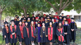
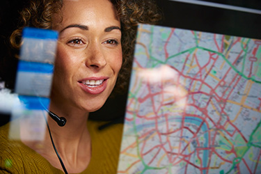
    María Leasure is an Air Force veteran, currently employed as a geospatial analyst at Crisis24, an integrated risk management company. She graduated from the USC Graduate Certificate in Geographic Information Science and Technology (GIST) in 2018, and the Master of Science in GIST in 2021. Below, Leasure details her favorite projects in the programs, including the Catalina Island fieldwork excursion, and her exciting professional work with GIS.

    Read our other recent Q&A with Army veteran and current M.S. in GIST student Kurtis Eisenhuth.

    View our previous military student and alumni Q&As.

    Request Brochure

    Fill out the information below to learn more about the University of Southern California’s GIS Graduate Programs and download a free brochure. If you have any additional questions, please call 213-325-2474 to speak to an enrollment specialist.

    University of Southern California has engaged AllCampus to help support your educational journey. AllCampus will contact you shortly in response to your request for information. About AllCampus. Privacy Policy. You may opt out of receiving communications at any time.

    * All Fields are Required. Your Privacy is Protected.

    How did you get involved with geospatial work in the military?

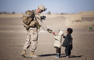
    Spatial awareness has always been essential in the military. In the Air Force, I served in an intelligence role, and being able to read maps and use GIS tools at some level was expected. Later, I was able to delve into spatial analysis techniques as part of a focused work group and became really interested in learning more.

    How do you use GIS in your current role?

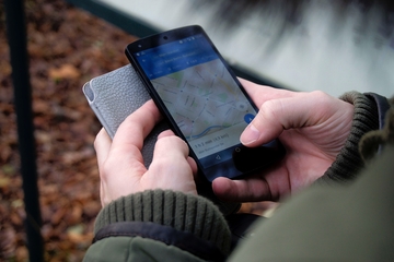
    My team provides mapping support for risk and security analysts, both by curating suitable spatial data and by creating cartographic products. We are also working on a project, for use by all kinds of travelers, to outline areas where there are risks not necessarily present in the wider region. For example, we might outline an area in a country where there are unexploded land mines to alert members of a client NGO who may work or drive in remote places.

    Why did you select the University of Southern California to complete the GIST programs?

    There were many reasons. Of course, USC has a strong faculty and a reputation for high academic standards, so that first drew me to the university. I loved that there was so much flexibility in campus locations, online options and course offerings in all semesters, which really helps students continue their professional work or research interests while working toward the degree. The field work component on Catalina was also a major factor.

    What was the online experience like for you?

    I liked that the core courses helped everyone get used to the online environment. I have to work asynchronously in my workplace, and I appreciate that it can be difficult for many people to feel engaged and communicate well if they are not used to it. USC created opportunities early on to establish connections to classmates.

    How were your experiences with faculty, staff and fellow students?

    I learned so much from the wide variety of backgrounds; this was a huge plus of the programs. It was a very supportive environment and everyone had a strong work ethic. That was important in group projects and peer reviews, which were always good experiences for me.

    How have the programs benefited you?

    Being exposed to different data integration and collection tools that I would not have known about without my coursework has been extremely valuable. Drone work and the FME (Feature Manipulation Engine) toolbox are a couple of specific examples.

    Learning about the different ways that GIS is used in various fields and organizations has helped me think more creatively about problem-solving. I have learned to organize, communicate and collaborate so much more effectively.

    What knowledge and skills did you acquire that you find especially valuable?

    It sounds funny, but I feel like I have finally learned how to learn – that is, to identify knowledge gaps and find a way to address them. I have a lot of confidence now in my ability to teach myself a new skill, and then to share that with others. I also feel like I can acknowledge major obstacles and work around them. We can’t always immediately solve problems, but we can still find a way forward.

    What was one of your favorite GIST projects?

    My committee managed to make my geodatabase thesis fun. It was still a lot of stress and work – I will not lie. But it was a great opportunity to explore a special interest of mine – archaeology and our earliest history – and to be so encouraged and challenged.

    The field research on Catalina, where we did a study on favorable environments for one of the cacti on the island, will also always be a favorite because of the close teamwork and awesome environment to explore a real-world question together. The Pacific coast is beautiful beyond words.


    About USC’s GIS Graduate Programs

    The University of Southern California offers a comprehensive selection of online and residential GIS programs. This includes both GIS master’s degrees and GIS graduate certificates. Click on the programs below to learn about our leading geographic information science education.

    GIS Master’s Degrees

    GIS Graduate Certificates

  2. How GIS and Big Data are Creating Big Change for the World

    Comments Off on How GIS and Big Data are Creating Big Change for the World

    Big Data in GIS
    The big data trend has dramatically impacted every industry, so it is little surprise that big data in GIS has significant implications for how we acquire and leverage spatial information. As we consider the way organizations are using geographic information science and technology, one of the clearest themes is that usage is expanding rapidly; whereas, historically, the largest adopters of geospatial data have been government agencies, it is now easy to find widespread GIS adoption in every business sector.

    The convergence of GIS with big data means that the potential applications of the two will become limitless. We wanted to look at why interest appears to have risen so dramatically and how different organizations are using big data together with GIS.

    Related Content: Learn How Air National Guard Analyst Adrianna Valenti uses GIS every day.

    Request Brochure

    Fill out the information below to learn more about the University of Southern California’s GIS Graduate Programs and download a free brochure. If you have any additional questions, please call 213-325-2474 to speak to an enrollment specialist.

    University of Southern California has engaged AllCampus to help support your educational journey. AllCampus will contact you shortly in response to your request for information. About AllCampus. Privacy Policy. You may opt out of receiving communications at any time.

    * All Fields are Required. Your Privacy is Protected.

    Big Data in GIS: Why Now?

    Big data is not a new trend by any means; McKinsey highlighted it as the next frontier for innovation even in 2011. However, it is becoming a larger part of geographic information science.

    Perhaps one of the biggest changes in the conversation around big data has been in the relationship between hardware, software and expertise. When the McKinsey report mentioned above was published, the cost of hardware presented a major big data challenge, even when considering just one type of computing resource. For example, the cost per gigabyte for computer storage in 2010 was 10 cents. In 2017, that dropped by a factor of five to two cents per gigabyte. We can see similar trends in processing power, memory and other hardware resources.

    Midsize organizations can now afford robust hardware for housing data and analytics tools that precisely meet their needs, and smaller organizations can invest in highly scalable cloud solutions, making big data platforms in GIS and other disciplines accessible to nearly anyone.

    As a result, the challenge of big data in GIS today is less about the hardware and more about finding people who can manage the huge volume of information and transform it into value for their organizations.


    Who’s Using Big Data in GIS and How?

    The global geospatial data analytics market is set for considerable growth, increasing from a projected $69.9 billion in 2018 to $88.3 billion in 2020. For context, revenue from geospatial analytics in 2018 is comparable to the global Software-as-a-Service market ($73.6 billion), which is far more mature and encompasses a much larger variety of software. Below are three disciplinary snapshots and how each might use big data in GIS as the technology and organizational understanding of analytics becomes more sophisticated.

    1. GIS and Big Data Empower Humanitarian Projects

    The United Nation’s Sustainable Development Goals (SDGs) represent a framework for achieving a “better and more sustainable future for all.” Technology advancements—including the Internet of Things, open data platforms, crowdsourced spatial data and the evolution of big data technology — have contributed to an incredibly vast amount of information being available that can help countries achieve the UN’s SDGs.

    For example, DigitalGlobe, an organization that sources satellite data and integrates it with other sources like social media sentiment and aerial imagery, leverages a GIS machine learning algorithm to track activity in specific locations and identify anomalies.

    The issues that DigitalGlobe helps to solve range from global poverty to child trafficking to disaster response. But the common theme in all its efforts Is that the volume of data working behind the scenes is vast. According to DigitalGlobe regional director Abhineet Jain, the organization collects approximately 80 gigabytes of data daily; as of January 2018, the organization had collected close to 100 petabytes of data total, or the equivalent amount of data to roughly 100 million hours of Netflix video streaming (only 33 million hours if you stream in HD).

    2. Geospatial Data Analytics in Marketing

    One of the most common uses for geospatial analytics in marketing has been in prospect or customer segmentation. Brands like Under Armour, for example, can use the data from fitness trackers to segment their audiences based on their level of physical activity, and deliver timely promotions based on an individual’s level of engagement with fitness and the Under Armour brand.

    As spatial data from disparate sources becomes more tightly integrated, however, marketers’ usage of geospatial analytics will become more complex. As an example, one area of increasing interest has been in tracking brand perception in individual regions using social media. For a brand like Under Armour, integrating this type of information with insights from their fitness tracking data could yield to better targeted messaging— such as by addressing a common customer frustration or aligning the way they talk about their products with the way customers actually use and feel about them.

    3. Financial Services Firms Use Big Data and GIS for Business Intelligence

    One of the most common uses for GIS in the banking industry has been in determining which branches to consolidate. However, GIS and big data are increasingly used together to address more complex issues. In the insurance industry, overlaying weather data with claim data, for example, can help companies detect possible instances of fraud.

    Along with telecommunications companies and government, financial services firms are leading when it comes to using GIS and business intelligence tools together. For the financial sector, geospatial big data is playing a role in creating a boom of startup companies. Many of the financial startups in this area have been marketing themselves for their ability to leverage non-traditional data sources, such as satellite imagery, for determining the potential risk of offering insurance or a loan. For example, satellite imagery over a span of time could better predict a property’s risk of flooding for determining insurance rates.


    Big Data and GIS: Looking to the Future

    The evolution of big data and its increasing value to GIS is both exciting and challenging. As mentioned before, big data is less of a hardware problem than it was in the early days of the trend. However, new challenges have emerged.

    Related Content: Top GIS Technologies in 2020 & Beyond

    For professionals within GIS, the challenge will be understanding the myriad of ways they could potentially leverage large volumes of data from many different sources and thinking of creative ways they may be able to capture and leverage new data sources. For the organizations that hire these professionals, the challenge will be identifying top talent, not just from a purely technical standpoint, but from their ability to form creative solutions to technical problems.


    About USC’s GIS Graduate Programs

    The University of Southern California offers a comprehensive selection of online and residential GIS programs. This includes both GIS master’s degrees and GIS graduate certificates. Click on the programs below to learn about our leading geographic information science education.

    GIS Master’s Degrees

    GIS Graduate Certificates

  3. Q&A with USC HSGI Alumnus Eli Ibanga

    Comments Off on Q&A with USC HSGI Alumnus Eli Ibanga

    Geospatial intelligence (GEOINT) is used across many careers, including in the government, military and within humanitarian organizations. USC alumnus Eli Ibanga was drawn to the versatile nature of the discipline and chose to pursue GEOINT education to build upon his knowledge gained in the military and through previous degree programs.

    Eli IbangaEli completed both the online M.S. in Human Security and Geospatial Intelligence (HSGI) and Graduate Certificate in Geospatial Intelligence programs with us. We previously spoke with Eli when he was a student in the M.S. in HSGI program, and we wanted to check in with him for his reflections on the programs and his time at USC now that he has graduated.

    Describe your background.

    My background is in the military/healthcare. I’m a U.S. Army Veteran, with military experience in program and strategy management.

    Why did you select USC’s online program among others that you may have been considering?

    I wanted to study in a field relevant to my previous experiences and degrees. I thought this program would be a great way to apply and expand my knowledge I’d gained in the military and through my prior M.S. in Homeland Security.

    Request Brochure

    Fill out the information below to learn more about the University of Southern California’s GIS Graduate Programs and download a free brochure. If you have any additional questions, please call 213-325-2474 to speak to an enrollment specialist.

    University of Southern California has engaged AllCampus to help support your educational journey. AllCampus will contact you shortly in response to your request for information. About AllCampus. Privacy Policy. You may opt out of receiving communications at any time.

    * All Fields are Required. Your Privacy is Protected.

    Did you have an “aha!” moment where you realized the geospatial intelligence (GEOINT) field was where you needed to be? If so, tell me about that moment.

    GEOINT is simply a different kind of analysis. When people say “think spatially,” what they mean is to execute analysis, and visualize the data and results in a way that is a bit atypical of other analysis techniques. The key strength of GEOINT is its focus on location and the world around you – that’s applicable to any field.

    What was the online learning experience like for you? How were your experiences with faculty, staff and fellow students?

    The online learning experience was smooth. I have a lot of experience with online degree programs, and I’ve found that USC’s programs are legitimately a cut above the rest. USC does a really good job of bringing online and on-campus students together. In fact, I’m still connected with several of my peers and instructors from my time at USC.

    How has the program benefitted you already and how do you foresee it benefitting you in the future?

    The program helped to “credential” my work experience, while imparting new knowledge and making me a more desirable candidate and speaker within the field. Several opportunities have been available to me that I wouldn’t have had without completing this program, such as speaking at the GEOINT 2019 Symposium on leveraging artificial intelligence for disaster and evacuation preparedness.

    What knowledge and skills did you acquire that you found especially valuable?

    The ability to speak about geospatial intelligence both at a technical and conversational level. The nature of the material makes that a key skill, and one that is also relevant in the workplace. You may be working with practitioners and analysts, as well as others not as familiar with GEOINT, which is why it’s important to adjust your language accordingly.

    What would you say was the biggest takeaway from your participation in the program?

    Know your craft and continue to learn and grow. To remain up to speed in this field, one must stay engaged and leave their comfort zone to ensure they have the tools needed to be successful. GEOINT is an evolving, dynamic discipline, as we continue to collect large amounts of spatial data and use advancements in technology to conduct analyses.

    What advice do you have for those who wish to pursue a career in GEOINT?

    Get smart on data science! That doesn’t necessarily mean you need to learn to program anything. But you should know enough to be able to have a low-level conversation with anyone that does. In USC’s M.S. in HSGI program, you have the opportunity to take a course called Spatial Programming and Customization, which helps to familiarize you and gives you hands-on experience with programming languages used in GIS software, like Python.

    What would you like others to know about this program?

    The M.S. in HSGI program isn’t tailored toward one specific type of candidate. Geographic information science, and by extension, GEOINT, is interdisciplinary. That means there are many different ways to learn how to apply the science, and it is relevant to many different fields and career trajectories. And for students in the online GIS programs, there is a lot of support available through the Spatial Sciences Institute. The staff is very much invested in helping students succeed in reaching their professional goals.


    About USC’s GIS Graduate Programs

    The University of Southern California offers a comprehensive selection of online and residential GIS programs. This includes both GIS master’s degrees and GIS graduate certificates. Click on the programs below to learn about our leading geographic information science education.

    GIS Master’s Degrees

    GIS Graduate Certificates

  4. Here’s Why It’s A Great Time to be in Geospatial Intelligence

    Comments Off on Here’s Why It’s A Great Time to be in Geospatial Intelligence

    While geographic information science (GIS) requires specialized knowledge to be successful, the discipline is full of varied opportunities. Geospatial intelligence (GEOINT) represents one of the dynamic areas where professionals can further evolve their GIS careers, pursuing opportunities with the government, military or with humanitarian organizations.
    Military Geospatial Imagery Intelligence Analyst with two small children
    For example, the U.S. Department of Homeland Security and the U.S. military rely heavily on geospatial intelligence to protect civilians and better understand the complex issues facing our country, from military threats to natural disasters. At the same time, humanitarian organizations use GEOINT for mitigating damage caused by a range of events and factors, as well as for effectively sending aid to populations facing crises.

    Related content: 4 Uses of Geospatial Intelligence

    Individuals who go into geospatial intelligence careers often refer to it as a calling rather than a job, making it an ideal career for GIS professionals who have a passion for protecting people and mitigating damage to critical services and infrastructure. Moreover, with the way GIS technology has evolved to take advantage of the digital age, the GEOINT field is benefitting from rapid advancements in technology that make it an exciting time to get involved.

    The examples and information below give a summary of the ways GEOINT professionals can hone their skills and leverage the latest geospatial intelligence trends.

    Request Brochure

    Fill out the information below to learn more about the University of Southern California’s GIS Graduate Programs and download a free brochure. If you have any additional questions, please call 213-325-2474 to speak to an enrollment specialist.

    University of Southern California has engaged AllCampus to help support your educational journey. AllCampus will contact you shortly in response to your request for information. About AllCampus. Privacy Policy. You may opt out of receiving communications at any time.

    * All Fields are Required. Your Privacy is Protected.

    Geospatial Intelligence Careers

    Disaster Relief

    In states like Florida, where flooding is a regular public safety hazard, geospatial intelligence has proven invaluable to helping government officials better plan for and respond to natural disasters. In terms of disaster relief, government officials can use GEOINT in a number of ways such as reviewing flood risk maps that show how water will likely distribute itself during a flood, and even the evaporation rates in a given area.

    One of the ways that GEOINT technology has evolved in the last several years is the ability to take in many different types of data. For example, officials working to mitigate flood damage in Florida can leverage characteristics that range from rainfall to the characteristics of aquifers to predict where resources are most needed.

    As a result, geospatial intelligence technology helps to tackle the problem from multiple angles. In addition to determining direct mitigation strategies, such as where additional infrastructure may need to be built, GEOINT helps determine a flood’s effect on clean water supplies. This can provide crucial information in determining relief efforts, such as effectively distributing clean water supplies while infrastructure is rebuilt.

    Disaster and Threat Response

    With natural disasters becoming an increasing threat in the United States, geospatial intelligence has proved to be invaluable in disaster response. For example, hurricane evacuation routes are crucial to determining how best to keep civilians safe in the event of a natural disaster. These overlay maps are used by the government to plan the best routes and analyze their effectiveness.

    Increasingly sophisticated video processing and image recognition tools have been a significant boon for GEOINT professionals. For example, the Los Angeles International Airport (LAX) uses 24/7 video imaging to track airport security in airfields and terminals, providing more accurate threat response than ever before.

    Military Operations

    GEOINT professionals have a range of opportunities in the U.S. military when it comes to geospatial intelligence careers. Although roles like geospatial intelligence imagery analysts are specific to the military, the skills they learn are applicable to numerous roles both within the military and in civilian GIS careers.

    The U.S. Air Force recently developed new geospatial intelligence technology that makes transmitting data faster and more accurate than ever. In the past, transmitting imagery to military in low bandwidth areas was tedious, requiring that images be sent in small files. Now GEOINT specialists have developed systems that allow images to be transmitted quickly, even in combat zones. The benefit of this technology is that combat strategies can be determined in minutes, even seconds, rather than the hours it would take for images to be transmitted.

    If you are interested in technology that helps both military organizations and civilians, hydrography is an advancing science used by geospatial intelligence to understand sea levels, prepare for natural disasters, and chart waterways for both military and commercial purposes. The U.S. Department of Commerce has implemented hydrography using this interactive map, which accounts for shifting water depths and silt channel changes that can quickly alter a ship’s course. This new technology takes out the guesswork of charting courses, allowing for safer and more effective transit.


    National Geospatial-Intelligence Agency

    The National Geospatial-Intelligence Agency (NGA) is the leading provider of geospatial intelligence in the United States. NGA services are impressive not only because of their accuracy, but because of the range of technologies they cover. NGA has impacted technology and services ranging from the navigation systems on mobile phones to national policy decisions.

    With roughly 14,500 employees, NGA offers a wide range of career opportunities for both military personnel and civilian employees, as well as contract work for certain projects. Much of NGA’s work supports federal government decisions on counterterrorism and elements of war combat on a national security level. NGA also provides aid to disaster relief initiatives across the U.S., giving a range of career opportunities for new professionals.

    NGA recently made public plans to build a state of the art geospatial intelligence headquarters in St. Louis, MO. Construction of the facility is being overseen by the U.S. Air Force and the U.S. Army Corps of Engineers, with plans of completion set for 2024.

    The need for a more robust facility highlights the growing need for geospatial intelligence in military operations and offers a healthy number of new job opportunities in the near future.


    Geospatial Intelligence Salaries

    While GIS professionals often go into the field of geospatial intelligence in the spirit of service, it’s always practical to look at making a sustainable income. Geospatial intelligence salaries begin at a median range of $58k for geospatial analysts, and roles within the field offer numerous paths for advancement into senior analyst or management positions. For example, the median salary for a senior intelligence analyst with a GEOINT skillset is $96k.

    Opportunities to manage teams of analysts or provide strategic direction for GEOINT organizations provide a path toward leadership, for those with a passion for helping their teams operate at their best.


    About USC’s GIS Graduate Programs

    The University of Southern California offers a comprehensive selection of online and residential GIS programs. This includes both GIS master’s degrees and GIS graduate certificates. Click on the programs below to learn about our leading geographic information science education.

    GIS Master’s Degrees

    GIS Graduate Certificates

  5. USC Study Finds STEM Degrees Pay Off for Minority College

    Comments Off on USC Study Finds STEM Degrees Pay Off for Minority College

    STEM Degrees Pay Off for Minority College
    Minority college students who major in the STEM fields – science, technology, engineering and math – earn at least 25 percent more than their peers who study humanities or education, according to the results of a new USC study.

    And those who took jobs related to their STEM degrees earned at least 50 percent more than their classmates who majored in humanities or education fields.

    Published in Research in Higher Education, the study followed more than 1,000 Asian and Pacific Islander, Latino and black students over nine years. The students were scholarship applicants for the Gates Millennium Scholars program funded by the Bill & Melinda Gates Foundation, which awards grants to highly motivated, low-income minority students.

    While minority groups continue to be underrepresented in the STEM fields, the study’s researchers believe this will change if students understand how much more money can be earned in those fields.

    “The premiums for majoring in STEM fields are huge,” said lead author Tatiana Melguizo, associate professor of education at the USC Rossier School of Education. “We need to educate students that if they get a job in a STEM-related occupation, they have an even higher earning premium. Otherwise, students are not reaping the economic benefit of all the hard work they went through as undergrads.”

    Overall, Latinos reported the highest average earnings after college – $42,180 annually – relative to the other minority groups. Black students reported earning $35,900 and Asian-Pacific Islanders earned $40,261 (data in 2006 dollars).

    Latinos majoring in STEM fields also reported the highest earnings among the groups studied: an average of $56,875 per year, higher than the reported average salaries of $39,365 for blacks and $47,530 for Asian-Pacific Islanders.

    The study’s authors said more research must be done to determine whether these discrepancies are attributable to different career preferences among racial and ethnic groups or employers’ hiring decisions, as well as the role colleges and universities play in the career and occupational development of minority students.

    “Among the high-achieving minority students we studied, Latinos not only reported the highest annual earnings overall but also reported the highest annual earnings among STEM majors,” said study co-author Gregory Wolniak, a senior research scientist at the independent research organization NORC at the University of Chicago. “Preliminary findings suggest this may partially be due to Latino students’ ability to find jobs related to their major. These findings are encouraging signs that strengthening the pipeline of underrepresented students into STEM careers offers a viable solution to our nation’s growing competitiveness problem in engineering and science fields.”

    Funding for the study was provided by the Bill & Melinda Gates Foundation through the Institute for Higher Education Policy.

    Source: https://news.usc.edu/36235/usc-study-finds-stem-degrees-pay-off-for-minority-college-students/
    Originally posted on June 22, 2012

    Request Brochure

    Fill out the information below to learn more about the University of Southern California’s GIS Graduate Programs and download a free brochure. If you have any additional questions, please call 213-325-2474 to speak to an enrollment specialist.

    University of Southern California has engaged AllCampus to help support your educational journey. AllCampus will contact you shortly in response to your request for information. About AllCampus. Privacy Policy. You may opt out of receiving communications at any time.

    * All Fields are Required. Your Privacy is Protected.

    About USC’s GIS Graduate Programs

    The University of Southern California offers a comprehensive selection of online and residential GIS programs. This includes both GIS master’s degrees and GIS graduate certificates. Click on the programs below to learn about our leading geographic information science education.

    GIS Master’s Degrees

    GIS Graduate Certificates

  6. GIS and Cybersecurity

    Comments Off on GIS and Cybersecurity

    High-profile incidents like the Equifax data breach and WannaCry ransomware attack have ensured that cybersecurity is a top priority for organizations of all kinds. Retailers that process payments, hospitals entrusted with confidential patient information and local governments conducting elections are all highly conscious of the threats posed by phishing scams, denial-of-service attacks and malware. According to Ponemon Institute’s annual Cost of a Data Breach Study for 2018, the average data breach costs $3.86 million, a 6.4 percent increase from the previous year.

    Cybersecurity professionals employ a variety of tools and strategies to prevent the financial losses and reputational damage that result from these intrusions. Geographic information science offers resources that can help organizations analyze potentially compromised systems and develop stronger defenses. The role of GIS in cybersecurity continues to expand as more businesses discover the value of geospatial problem-solving for stopping an evolving array of dangers.

    Request Brochure

    Fill out the information below to learn more about the University of Southern California’s GIS Graduate Programs and download a free brochure. If you have any additional questions, please call 213-325-2474 to speak to an enrollment specialist.

    University of Southern California has engaged AllCampus to help support your educational journey. AllCampus will contact you shortly in response to your request for information. About AllCampus. Privacy Policy. You may opt out of receiving communications at any time.

    * All Fields are Required. Your Privacy is Protected.

    Mapping Cybersecurity Threats

    Systems detect more infections with every passing second around the world. GIS helps us to understand the scale of this problem and detect meaningful trends. Mapping cyberattacks in real time reveals just how common such incidents are and how important it is for organizations to have updated countermeasures in place.

    Fortunately, spatial information also helps more directly, allowing security experts to discover unauthorized activity early. To minimize the consequences of a data breach or malware attack, stakeholders need to communicate clearly and coordinate an immediate response. GIS can provide clear visualizations of the systems involved in an incident and promote situational awareness across multiple departments.

    An Esri white paper showed how organizations can map out the connections between devices and coordinate their responses to intrusions. In this example, cyberspace is visualized in five layers:
    Cybersecurity and GIS

    • The social/persona layer, including all the employees using a network
    • The device layer of those individuals’ computers and phones
    • The logical network layer showing the connections between devices
    • The physical network layer displaying the underlying infrastructure
    • The geographic layer revealing the physical locations of all the relevant devices and systems

    A detailed perspective on the flow of data through an organization’s network leads to actionable intelligence about any disruptions or device failures that may interfere with operations. Spatial information ties an incident to specific places, allowing experts to judge whether the issue stems from an intentional attempt to compromise the system and assess the effects. Maps can then guide cybersecurity and IT personnel as they set priorities and decisively head off the intrusion.


    Protecting Infrastructure

    In our globally connected world, cybersecurity is crucial to keep essential infrastructure functioning properly. For example, a 2018 report from the U.S. Department of Energy noted that even as electrical power systems become more reliant on connections to the Internet, the safeguards at many energy companies have not kept pace with cyber threats. The DOE warned that, without proactive steps to address vulnerabilities in the power grid, compromised systems could prove disastrous for communities.

    Cyberattacks on energy providers may take various forms, such as sending inaccurate information about the demand for power in particular areas. Systems responding to these false estimates of electricity use might cause imbalances and power outages. Fortunately, GIS can help to address this vulnerability.

    Detection software uses GIS mapping to monitor the distribution of energy, giving energy companies greater visibility into operations throughout the power grid. Meanwhile, security detection algorithms can spot issues in the distribution load that might indicate that operators are receiving deceptive information. If any anomalies show up, energy providers can evaluate whether they are the result of a hack and respond accordingly.


    Maintaining Geospatial Data Security

    A huge wealth of spatial information, like many of the findings gathered by NASA probes, is readily available to the public and researchers. However, some organizations retain spatial data that is proprietary or must be kept confidential due to security or privacy concerns. For example, geographic details may compromise the privacy of individuals who participate in healthcare or social science studies.

    In these cases, cybersecurity professionals must implement a layer of security that prevents unauthorized access to geospatial information and metadata. Effective access control mechanisms may include:

    • Clearly defined policy specifications for who can use geospatial features
    • Semantic reasoner software to enforce those policies
    • Identity management systems to check the credentials of users
    • Data authenticity verification

    About USC’s GIS Graduate Programs

    The University of Southern California offers a comprehensive selection of online and residential GIS programs. This includes both GIS master’s degrees and GIS graduate certificates. Click on the programs below to learn about our leading geographic information science education.

    GIS Master’s Degrees

    GIS Graduate Certificates


    Request Brochure

    Fill out the information below to learn more about the University of Southern California’s GIS Graduate Programs and download a free brochure. If you have any additional questions, please call 213-325-2474 to speak to an enrollment specialist.

    University of Southern California has engaged AllCampus to help support your educational journey. AllCampus will contact you shortly in response to your request for information. About AllCampus. Privacy Policy. You may opt out of receiving communications at any time.

    * All Fields are Required. Your Privacy is Protected.

  7. Top Companies Using GIS Technology

    Comments Off on Top Companies Using GIS Technology

    Geographic Information Science and Technology (GIST) can be used by businesses large and small for a variety of applications. Companies that use GIS technology today are those in industries ranging from supply chain management to insurance to urban planning, banking, and health – and much more.


    Climbing the Charts Using GIS

    When discussing top companies that use GIS technology, we need some way to qualify “top.” So, let’s focus on the companies that land among the Fortune 500 list.
    top gis companies
    Before exploring the top companies using GIS, however, it’s important to talk about GIS software and services. Esri, is one well-known GIS company, having existed for roughly 50 years, that has risen to the top of the field. In recent years, Esri was seen as the dominant player in the GIS market, with a 43% share, according to a 2015 report from ARC Advisory Group. Its technology is used by more than 350,000 organizations around the globe, including more than two-thirds of the Fortune 500.

    “Executives are waking up to realize that they can do a lot better, save money, make better decisions if they optimize and start thinking geographically and have a location strategy,” as Esri founder Jack Dangermond said in a recent interview.

    Request Brochure

    Fill out the information below to learn more about the University of Southern California’s GIS Graduate Programs and download a free brochure. If you have any additional questions, please call 213-325-2474 to speak to an enrollment specialist.

    University of Southern California has engaged AllCampus to help support your educational journey. AllCampus will contact you shortly in response to your request for information. About AllCampus. Privacy Policy. You may opt out of receiving communications at any time.

    * All Fields are Required. Your Privacy is Protected.

    Companies Using GIS: The Obvious

    Technology companies such as Apple, Microsoft, and Alphabet (Google’s parent company) are all companies that use GIS. And, any smartphone user who checks weather radar or uses Google Maps is a GIS user themselves. In fact, mobile technology and the “app revolution,” as Dangermond calls it, is a major driver of the rising number of organizations that use GIS.

    Online retail giant Amazon is another prominent GIS-centric company, making use of the technology to devise offerings and marketing campaigns that meet the unique needs of customer groups around the world. And of course, it’s easy to imagine how telecommunications companies like AT&T and Verizon might use GIS to better serve their customer bases — such as by identifying locations where new cell towers or better communications infrastructure may be needed — as well as expand into new geographies that may be underrepresented when it comes to Internet and cellular connectivity.

    Insurance companies like UnitedHealth Group, Anthem, Express Scripts Holding, and State Farm Insurance Cos. – all of which are in the top 40 of the Fortune 500 – are using GIS to predict risk and help determine premiums. For example, a customer who lives in an area that is more prone to earthquakes or perhaps has a greater propensity toward crime, would land in a higher risk group and pay premiums accordingly. Conversely, a customer living in a low-crime area with minimal risk from natural disasters could benefit from lower rates.


    Companies Using GIS: The Not-So-Obvious

    While you might not necessarily think of Walmart as a GIS company, anytime the multi-hundred-billion-dollar company wants to expand into a new area, it overlays spatial information with its other market research to determine optimal locations for placing a store or buying land.

    And for managing its supply chain, Walmart uses GIS to track the distance and number of steps between the dock and the store, according to this infographic. “This allows the company to optimize routes to the shipping dock and track the number of times a product gets touched along the way to the customer,” the infographic says. Further, Walmart uses geospatial data to analyze transportation routes for its fleets of trucks, helping it keep transportation costs down and best schedule driver times.

    And really, any business can derive the same benefits from using GIS, helping them remain competitive with other top companies. When businesses like Home Depot or Johnson & Johnson expand into a new area, using GIS becomes a necessity for maximizing their investments.


    Using GIS: The ‘Geographic Advantage’

    More and more organizations are leveraging GIS as mapping and location analytics become democratized. In particular, one of the biggest growth areas for GIS applications in the commercial sector, which Esri sees growing 30% year-over-year within its business.

    “It takes a while for executives to understand that every company is a spatial company, fundamentally: where are our assets, where are our customers, where are our sales,” Esri’s Dangermond said. “But when they get it, they light up and say, ‘I want to get the geographic advantage.’”

    With the evolution of trends like the Internet of Things (IoT), there will be even more spatial data to leverage. As a result, there will be few businesses left in the coming years that aren’t using GIS. Regardless of whether we’re talking small or large retailers, transportation, logistics optimization, wholesalers, or supply chain logistics, to remain competitive, almost any business must become a GIS company.


    About USC’s GIS Graduate Programs

    The University of Southern California offers a comprehensive selection of online and residential GIS programs. This includes both GIS master’s degrees and GIS graduate certificates. Click on the programs below to learn about our leading geographic information science education.

    GIS Master’s Degrees

    GIS Graduate Certificates

  8. The Application of GIS Technology for Nonprofit Organizations

    Comments Off on The Application of GIS Technology for Nonprofit Organizations

    GIS in the nonprofit sector
    With each passing year, Geographic Information Science (GIS) technology offers new insights for businesses and organizations. From using geospatial analytics to analyze crime, to the development of drones, GIS technology offers seemingly endless opportunities for growth and innovation.

    One of the key areas where GIS has become an invaluable resource is the nonprofit sector. GIS technology in the nonprofit sector offers numerous advantages, such as aiding organizations in optimizing their development strategies for specific donors and patrons or better communicating their missions to the general public.

    For example, GIS professionals can analyze the communities where humanitarian work is being done to better allocate resources or map success stories related to their organization’s goals.

    Request Brochure

    Fill out the information below to learn more about the University of Southern California’s GIS Graduate Programs and download a free brochure. If you have any additional questions, please call 213-325-2474 to speak to an enrollment specialist.

    University of Southern California has engaged AllCampus to help support your educational journey. AllCampus will contact you shortly in response to your request for information. About AllCampus. Privacy Policy. You may opt out of receiving communications at any time.

    * All Fields are Required. Your Privacy is Protected.

    GIS Technology in the Nonprofit Sector

    The growth of GIS technology has drastically changed the way nonprofits identify and communicate with patrons and donors. While GIS might seem better suited to large nonprofits with a national reach, it can be equally useful to community-based nonprofits with a focused mission.


    GIS Mapping To Track Donor Relations

    The sustainability of nonprofits relies in large part on corporate and private donations. While GIS can be used to identify donors for the purposes of marketing and fundraising campaigns, the technology is also beneficial in showing need.

    For example, the nonprofit Direct Relief used GIS mapping to provide medical care to Syrian refugees and shared the mapping information with their donors to demonstrate where and how resources were allocated. This information was beneficial to building a healthy, transparent relationship with both corporate and private donors.


    GIS Mapping To Track Progress

    At the end of the day, the goal of any nonprofit is to determine whether or not it’s meeting its mission. That means providing the right type of programming, effectively reaching out to patrons, and tracking the success of their strategies.

    GIS applications offer a way of not only monitoring this success but communicating complex information related to an organization’s goals.

    For example, digital mapping can lay out this information in a visual way, so that stakeholders can see where they’re succeeding, the areas where they may be falling short, and places where there is opportunity for growth.

    Recently, the National Audubon Society used GIS mapping as part of a grassroots effort to share data among local chapters in New York State. The organization was able to link numerous disconnected databases through GIS and ultimately produce better science. This initiative was tied into the Society’s core mission of giving local chapters the tools they need to be experts in conservation within their communities.


    GIS Mapping in Nonprofit Jobs

    The application of GIS technology in the nonprofit sector offers a variety of paths for recent graduates. Professionals within numerous GIS career disciplines can apply their skills at environmental organizations, museums, and community-based groups where it’s crucial to have an understanding of the surrounding area that the organization serves.

    Museums provide ample job opportunities for GIS specialists, particularly in areas of conservation and ecology. Specialists can work within a GIS team at larger institutions and study ecological trends in the community. On the curatorial side of museums, larger audiences are being reached by providing online collections that leverage interactive spatial information to paint a clearer picture of the collection’s cultural and historical significance.

    One recent example comes from the Rome Reborn project, which used GIS technology to create 3D models of ancient Rome based off archeological and geographic data. This type of 3D mapping gives museums a tangible way for patrons to interact with ancient civilizations.

    Organizations specializing in land and animal conservation regularly seek GIS specialists to help carry out their mission. In fact, any nonprofit job related to the environment will require some knowledge of GIS, and that trend will continue to grow in the coming years. If you’re already skilled in a field of science, adding a degree in GIS creates a pathway to senior-level jobs at environmental nonprofits.

    Many current and former USC GIST master’s students have done significant work contributing to the environment and conservation. Visit our library of master’s theses to read more on the types of projects students have worked on.


    Networking with GIS Professionals

    A great way to network with fellow professionals in the field is to join a GIS organization. Due to the growing demand and variety of ways in which GIS can be applied, there are a number of groups for specific industries and nonprofits.

    Students in USC’s GIST and HSGI programs have a unique opportunity to begin networking with GIS professionals during the weeklong field excursion at USC’s Wrigley Marine Science Center on Catalina Island. The program offers opportunities to meet with a global team of researchers and work closely with USC’s faculty while conducting GIS fieldwork. Students conduct and present findings on spatial data and collection during this immersive experience.

    Outside of USC’s program, The American Association of Geographers (AAG) offers a number of opportunities to network with fellow professionals at different stages of their careers. Their annual conference and publications allow GIS specialists to stay informed and marketable in their field. AAG also has a substantive grants program allowing for further professional development.

    The Geospatial Information and Technology Association (GITA) is ideal for professional who are just starting in the field. The association offers events throughout the year, and varying rates depending on where you are in your career path. GITA’s professional development materials includes industry-related articles, a reference site, and webinars.

    Finally, The Cartography and Geographic Information Society (CaGIS) focuses on bringing together an understanding of cartography and geographic information in order to improve quality of life. In addition to publications and an annual conference, CaGIS offers awards and scholarships to students who showcase excellence while studying GIS.

    Whatever GIS organizations you decide to join or contribute to, remember that the end goal is connection. Professionals in the field of GIS are passionate about what they do and can help you find work that is most meaningful to you.


    About USC’s GIS Graduate Programs

    The University of Southern California offers a comprehensive selection of online and residential GIS programs. This includes both GIS master’s degrees and GIS graduate certificates. Click on the programs below to learn about our leading geographic information science education.

    GIS Master’s Degrees

    GIS Graduate Certificates

  9. The Fundamentals of Cartography

    Comments Off on The Fundamentals of Cartography

    At its core, cartography is about the visual representation of a space or place. While this may seem like a simple concept at first glance, it can become infinitely complex when you consider the number of choices that have to be made when creating a map.
    Fundamentals of Cartography
    In addition, modern mapmakers have a greater variety and a much greater volume of data to leverage; because of this complexity, we wanted to look at the fundamentals of cartography and explore the key elements of mapping as well as the purpose and usage of different kinds of maps.

    Related Content: Read more about our cartography and visualization course.

    Request Brochure

    Fill out the information below to learn more about the University of Southern California’s GIS Graduate Programs and download a free brochure. If you have any additional questions, please call 213-325-2474 to speak to an enrollment specialist.

    University of Southern California has engaged AllCampus to help support your educational journey. AllCampus will contact you shortly in response to your request for information. About AllCampus. Privacy Policy. You may opt out of receiving communications at any time.

    * All Fields are Required. Your Privacy is Protected.

    Fundamentals of Cartography

    The possibilities for mapmaking have expanded considerably alongside advancements in digital mapping. For example, GIS and cloud computing have made it possible for many more map designers to access sophisticated mapping software and huge volumes of spatial information that would have been too expensive or too cumbersome to store prior to the maturity of the cloud market.

    Perhaps one of the underrated benefits of these advancements is that lowering the barrier to entry into cartography has made it possible for maps to be created for a wide variety of purposes, ranging from maps that help aid disaster relief workers to maps created just for fun and to challenge cartographers’ creativity.

    Despite the dramatic evolutions in how maps are designed and what kinds of information it is capable to show with them, many of the fundamentals of cartography remain the same as they did decades ago. For instance, the 1969 book Fundamentals of Cartography highlighted the fact that cartography brings together geographic science, technical and artistic skills. This remains a key combination of skills for modern cartography.

    Because maps are tools for communication, cartographers must be able to assess spatial data, determine its relevance to the information they want the viewer to understand and determine the best way to showcase that information. Furthermore, creative skills are essential to displaying the appropriate information in a user-friendly manner and to make the information easily understood by map viewers.

    This aligns with the fundamental aspects of cartographers’ work outlined by the U.S. Bureau of Labor Statistics, which include:

    • Collect geographic data
    • Create visual representations of data, such as annual precipitation patterns
    • Examine and compile data from ground surveys, reports, aerial photographs, and satellite images
    • Prepare maps in digital or graphic form for environmental and educational purposes
    • Update and revise existing maps and charts

    One of the major elements that have changed in cartography is the scope and possibilities for mapping formerly inaccessible regions of the universe – mapmaking used to be primarily concerned with portraying the geography of Earth due to limitations in our ability to collect information about the geography of other planets. However, the use of GIS in space missions has helped create maps of the surface of Mars, and it is likely that our maps of the universe will grow more detailed and more expansive as our capabilities evolve.


    Types of Cartography

    While maps are designed to show information about the world, the type of information and how it is displayed can vary dramatically, even when considering different maps of the exact same region. For example, a geographical map of an area would serve a different purpose from one that showed the biodiversity in the same region.

    The Intergovernmental Committee on Surveying and Mapping identifies several broad types of cartography:

    • General Reference
    • Topographic Maps
    • Thematic
    • Navigation Charts
    • Cadastral Maps and Plans

    Some of the categories of maps above differ primarily in the level and type of detail they provide. For example, general reference maps and topographic maps are both designed to show features within a given area, but topographic maps include elevation details. There may also be overlapping categories within a single map; a topographic map may also have elements more aligned with thematic maps, such as weather or geological information.


    About USC’s GIS Graduate Programs

    The University of Southern California offers a comprehensive selection of online and residential GIS programs. This includes both GIS master’s degrees and GIS graduate certificates. Click on the programs below to learn about our leading geographic information science education.

    GIS Master’s Degrees

    GIS Graduate Certificates

  10. Predicting and Managing Chaos: How GIS Has Transformed Natural Disaster Relief

    Comments Off on Predicting and Managing Chaos: How GIS Has Transformed Natural Disaster Relief

    Hurricanes, wildfires, mudslides and other natural disasters can cause considerable chaos — damaging the environment, affecting communities and complicating rescue/relief efforts. But thanks to GIS, emergency management professionals are better equipped than ever to help communities prepare and recover.
    how gis has transformed natural disaster relief
    From tracking and predicting disasters to assisting in rescue, recovery and relief efforts, GIS is mitigating risk and damages, and saving lives.

    USC’s online graduate programs in GIST can equip you with the future-focused spatial expertise to manage disasters — and more accurately and thoroughly prepare for them before they happen.

    Request Brochure

    Fill out the information below to learn more about the University of Southern California’s GIS Graduate Programs and download a free brochure. If you have any additional questions, please call 213-325-2474 to speak to an enrollment specialist.

    University of Southern California has engaged AllCampus to help support your educational journey. AllCampus will contact you shortly in response to your request for information. About AllCampus. Privacy Policy. You may opt out of receiving communications at any time.

    * All Fields are Required. Your Privacy is Protected.

    Hazard mapping hurricanes before landfall

    Collecting actionable GIS data before and after a major hurricane can completely alter how a region recovers from wind, water and storm damage. In states such as Florida, the Carolinas, Louisiana and Texas, compiling data for hazard mapping and rescue measures is a top priority—and it makes a measurable difference.

    When Hurricane Irma hit, the city of Key West, Florida, had an extensive preparation strategy and a damage control plan for after the storm passed. City officials downloaded map-based data from previous disasters before the storm hit to prepare.

    After the region lost power, the data helped keep relief efforts moving and helped officials strategize about how to help the disaster-strewn city recover.

    City officials used the Collector mobile application that’s part of Esri’s ArcGIS software suite to create a debris assessment so they could assess and rate each vulnerability. The program allowed them to drop a pin on a map and detail the damage in that area, including photos. This helped them send FEMA and construction teams to the hardest-hit locations.

    Since then, Key West’s Emergency Operations Center has used ArcGIS to map the footprints of every building in the city. Continuing to collect data allows the city to develop a live map of the buildings, streets and even vegetation, meaning they can record and report future damage faster and smoother.

    In the future, they plan to implement a crowdsourcing feature that allows residents who stay through a storm to report damage through a streamlined process.


    Geo-targeting regions in the path of mudslides

    While states on the West Coast may not have to worry about hurricanes, they do deal with devastating mudslides caused by intense rainfall, snow or earthquakes. Geospatial software can prove useful in these situations, as it has the functionality to:

    • Illustrate actual and potential debris flow in mudslide-heavy areas
    • Provide pertinent demographic information for impacted areas such as population density
    • Warn residents of potential danger
    • Display the impact of heavy rain or flooding on the terrain in a given area

    With these insights, residents can more accurately assess whether they are in danger, and rescue workers can map out and prioritize assistance to areas with the greatest potential risk or greatest concentration of people.


    Limiting the destructive impact of wildfires

    Wildfires are unpredictable, but GIS technology can provide tools to monitor, forecast and minimize their impact.

    The conditions affecting a fire can be collected in real time via UAVs and drones, and compiled alongside predictive data like wind speed and direction. The data is then fed into GIS software specifically customized for firefighters, giving them information they need to make decisions and act proactively. Real-time maps can also alert residents to impending danger, and show safe escape routes.

    GIS in the aftermath of a natural disaster

    Even after a disaster has passed, the work isn’t over, and GIS plays a vital role in recovery. Real-time mapping that leverages remote sensing technologies such as LiDAR allows emergency management professionals to check safety, monitor cleanup progress and determine if roadways are open.

    Once emergency management professionals know which routes are compromised, they can use digital maps to find safer routes. GIS software makes these decisions quick and efficient and helps get safety teams, residents and businesses back on their feet.


    GIS and cost mitigation

    In 2017, 16 weather-related disasters produced losses of more than $1 billion each, according to the National Oceanic and Atmospheric Administration.

    GIS technology can help cities that have been affected by natural disasters secure relief funding. In the case of Hurricane Irma and Key West, Florida, GIS tracking and reporting ensured the city got its costs reimbursed by the Federal Emergency Management Agency (FEMA) and received the amount of funding needed to make renovations.

    FEMA also awards points that translate into discounts on flood insurance premiums to communities that prove they have taken measures to become more flood resilient. Using GIS technology—communities have the proof FEMA requires for the discount. Key West has secured a 15-percent reduction for both the city and its citizens due to the amount of action taken and documented.


    Learn disaster management from a global leader

    GIS technology is paramount to predicting the impact of disasters, managing their effects in real time or near real time, and recovering in the aftermath. USC can put you at the forefront of disaster management with an online master’s in geographic information science and technology taught by world-class faculty.

    The program features courses in Spatial Modeling, Spatial Analysis and Remote Sensing to connect you to the future of disaster management through GIS.

    Visit the online GIST certificate and program page to learn all the ways you can develop into a spatial expert.


    About USC’s GIS Graduate Programs

    The University of Southern California offers a comprehensive selection of online and residential GIS programs. This includes both GIS master’s degrees and GIS graduate certificates. Click on the programs below to learn about our leading geographic information science education.

    GIS Master’s Degrees

    GIS Graduate Certificates