Join us for the Graduate GIS Programs Information Session May 7 at 12 p.m. PT Register Today
USC Dornsife Spatial Sciences Institute

Author Archives: actemplatestg

  1. 4 Types of People Who Will Make it in GIS

    Comments Off on 4 Types of People Who Will Make it in GIS

    Careers in geographic information science (GIS) are full of exciting problems that can be solved with state-of-the-art tools and methods. GIS professionals have opportunities to lead projects, drawing on insights from geospatial data to achieve results. By effectively applying spatial reasoning, experts can strategize for business growth, make new archaeological discoveries, drive improved outcomes for public health or plan urban development.

    It takes a combination of technical knowledge and soft skills to address these complex issues and answer the questions facing today’s organizations. That means geospatial problem-solvers must be individuals who have hands-on experience and are prepared to stay up-to-date on the latest techniques. Here are four types of people who are likely to possess some of the essential GIS skills they need to succeed in these careers:

    Request Brochure

    Fill out the information below to learn more about the University of Southern California’s GIS Graduate Programs and download a free brochure. If you have any additional questions, please call 213-325-2474 to speak to an enrollment specialist.

    University of Southern California has engaged AllCampus to help support your educational journey. AllCampus will contact you shortly in response to your request for information. About AllCampus. Privacy Policy. You may opt out of receiving communications at any time.

    * All Fields are Required. Your Privacy is Protected.

    1. Programmers

    If you’re intrigued by spatial problems and already know how to code, you could be well on your way to building a career in GIS. Programming has emerged as one of the basic GIS skills necessary excel in the field, allowing experts to automate processes that would otherwise be time-intensive and highly repetitive.

    There are many programming languages that GIS professionals could find helpful in their careers. It isn’t essential to know each one, but a person who is proficient in at least one or two will find adapting to GIS software relatively simple. Some of the most common languages used in GIS today include:
    4 types of people that will make it in gis

    • Python
    • SQL
    • C++
    • C
    • C#
    • JavaScript
    • PHP
    • .NET

    Python is one of the most popular languages for professionals with GIS work experience because it can be applied to Esri’s ArcGIS and to open source QGIS desktop platforms. .NET can be used to modify ArcGIS for specific actions.

    JavaScript is ubiquitous on the web, serving as one of the key languages that make websites interactive and functional. As such, this language is very helpful in any web mapping project.
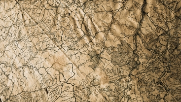
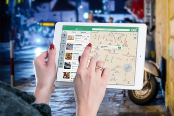

    2. Cartophiles

    If you become the de-facto navigator when visiting a new city and still collect roadmaps in your car as if your GPS could fail at any moment, you might enjoy a career focused on spatial data. People who have an affinity for maps are likely to find a natural fit in using GIS to solve problems.

    Understanding the principles of cartographic design is one of the most basic GIS skills. These concepts are valuable in collecting, organizing and displaying data in a readable format. Today’s cartographers make extensive use of digital tools to maintain accuracy when depicting a wide range of environments and make information accessible to people with impaired vision.

    Whether you’re digitizing traditional maps or working with web mapping applications, it’s essential to maintain quality throughout the development or revision process. Geospatial experts are most effective when they identify how geographic information and visualizations can address an issue or overcome a challenge and create maps accordingly.


    3. Communicators

    Communication is one of the most important soft skills in nearly any industry, but GIS professionals need to be able to get ideas across in numerous ways. First, it’s important that you’re able to communicate well with manager and peers. Productive collaborations depend on leaders who can explain the desired outcomes for a project or task, the steps it will take to get there and the challenges you may encounter along the way.

    Geospatial experts can tell detailed, engaging stories through mapping and provide context through text, images and multimedia content. The most powerful visualizations communicate their most important points in ways that non-experts can understand. The relevance of a striking data point should never be lost in poor design.

    Networking is another soft skill that’s important in most industries, and there are numerous professional organizations for GIS professionals. Getting to know others in the field could lead to job opportunities, helpful advice or just chances to discuss shared interests and gain fresh insights.


    4. Big-Picture Thinkers

    GIS skills go beyond learning to use mapping software or collect remote sensor data. Geospatial thinking is a discipline that deepens stakeholders’ understanding and guides strategic decision-making. The people who are best suited to thrive in this field know how to identify the crucial details in a project while always keeping the big picture in mind.

    When using GIS to solve problems, software tools become a powerful means of obtaining valuable insights and achieving an organization’s greater objectives. By considering the big picture, geospatial experts can make an impact in contexts ranging from military intelligence to real estate, offering insights into growing trends and revealing surprising connections. Professionals who see the wider implications of these findings are positioned to make a difference in their organizations.


    About USC’s GIS Graduate Programs

    The University of Southern California offers a comprehensive selection of online and residential GIS programs. This includes both GIS master’s degrees and GIS graduate certificates. Click on the programs below to learn about our leading geographic information science education.

    GIS Master’s Degrees

    GIS Graduate Certificates

  2. The Top 6 Industries for GIS

    Comments Off on The Top 6 Industries for GIS

    Geographic Information Science can bring together large amounts of geospatial data to help professionals make strategic decisions. Widespread GIS technology has led to a growing number of examples of GIS in business. Some of the best GIS projects may be those that utilize technology to improve community infrastructure and public health, but these complex information systems can also be used to save time, money and energy for companies and their facilities.

    Innovative professionals in virtually any industry can take advantage of GIS technology. Here are six popular examples of industries that use GIS:


    1. Supply Chain Management

    Over recent years, the processes for bringing products and services to the public have evolved immensely due to changing customer preferences and the rapid growth of ecommerce. Today, the ability to track shipments and inventory can make the supply chain more efficient, saving money for businesses that use GIS.
    Example of GIS usage in a city
    One example is the delivery of produce to supermarkets around the world. Agricultural products are picked on small farms and then distributed to grocers in many locations, often crossing state and national boundaries. The produce must arrive in top condition, ripe but not spoiled.

    GIS technology can tell agricultural and supply chain professionals when fruits or vegetables left the field, what routes they travelled and their quality upon arrival. If produce shows up at the supermarket looking unappetizing, workers can retrace the items’ path to identify problem areas and improve the odds that future deliveries will arrive in better condition.

    Request Brochure

    Fill out the information below to learn more about the University of Southern California’s GIS Graduate Programs and download a free brochure. If you have any additional questions, please call 213-325-2474 to speak to an enrollment specialist.

    University of Southern California has engaged AllCampus to help support your educational journey. AllCampus will contact you shortly in response to your request for information. About AllCampus. Privacy Policy. You may opt out of receiving communications at any time.

    * All Fields are Required. Your Privacy is Protected.

    2. Insurance

    Insurance companies rely on accurate predictions to determine risk. A wide range of factors come into play, but in nearly all insurance sectors, location is a strong indicator of risk. Certain regions are more prone to earthquakes, hurricanes, floods or other natural disasters, and social factors – like a propensity toward crime – tend to cluster in specific areas as well.

    With improved predictions, insurance companies can set coverage rates more appropriately. GIS software allows professional to map risk levels based on information such as:

    • Historic records, which could highlight the likelihood of an occurrence like a hurricane
    • Demographics, which might give insight into whether people are likely to be involved in a car accident
    • Local geography, which could indicate the possibility of an event such as a landslide

    3. Forestry and Timber

    Forestry is a complex field that analyzes conditions in wooded areas to determine how to best utilize land, preserve ecosystems or efficiently plan harvests. When poor forest management results in over-utilization, GIS aids in re-establishing plant species. Afforestation and tree species regeneration programs are most effective if foresters accurately determine what land plots will allow tree species to thrive. GIS technologies can map out important details like annual rainfall, minimum and maximum temperatures, the length and severity of the dry season and more.

    GIS systems also collect data that is relevant to the preservation of ecosystems, like the species found in an area and how populations are changing over time. Recording accurate, up-to-date information helps forest preservation professionals identify positive or negative patterns.

    Foresters are beginning to use GIS to support responsible timber harvesting. Tracking data like soil type and condition, roads, forest type and more can all support a cost-benefit analysis. By monitoring losses due to pests, foresters promote economically sound harvesting practices.


    4. Urban Planning

    Planning a city takes more strategy than simply identifying vacant lots and constructing buildings in them. The placement of business, governmental, public and residential structures impacts the quality of life of citizens who live there.

    As modern cities grow, planners have less space to work with when they need to add a building or a road or replace aging infrastructure. Developers also must account for the impact they may have on animal and plant life. To responsibly accommodate a community’s citizens while minimizing harm to existing historic structures or natural spaces, urban planners rely heavily on GIS technology.

    Planners can also review spatial information to determine the most efficient way to introduce alternative energy resources to a city. GIS mapping may help identify the best places to build out wind or solar farms, or install renewable energy infrastructure on a smaller scale, like in underutilized parking lots.


    5. Banking

    Banks choose their branch locations very carefully, considering factors like the potential customer base and local crime rates. As the landscape of banking changes due to increased usage of online services and trends in consumers’ preferences, financial institutions must make strategic decisions. In some cases, institutions need to close or consolidate branches to boost profitability. The tricky part is knowing which branches to close, especially when some are still performing well.

    Before adopting GIS software, decision makers often viewed branch locations on a physical map taped to a wall, stuck with pins or marked with Sharpies. GIS software makes it much easier for banks to identify locations with lower utilization rates, higher loan default rates or nearby competitors.

    GIS can also be used to map out demographics and see which areas may be most in need of specific products. For example, someplace with high rates of car ownership may have a greater need for auto insurance.


    6. Health and Human Services

    The field of public health focuses on patterns of disease within communities, directing prevention efforts and efficiently addressing problems as they emerge. Medical professionals have long been aware that location can impact patients’ well-being, and modern GIS technology can help health organizations analyze significant trends. Health and human services organizations use software to map cases of a disease, identifying high-risk areas or common origination points.

    The Centers for Disease Control and Prevention utilize GIS technology to manage a wide array of public health issues. For example, a map detailing heart disease death rates from 2011-2013 shows high risk in the Southern U.S. and the state of Nevada. Meanwhile, residents of Minnesota, the Pacific Northwest and Colorado are at much lower risk. With this information, public health professionals might take steps like deploying awareness campaigns about heart disease prevention in the areas where they are most needed.


    About USC’s GIS Graduate Programs

    The University of Southern California offers a comprehensive selection of online and residential GIS programs. This includes both GIS master’s degrees and GIS graduate certificates. Click on the programs below to learn about our leading geographic information science education.

    GIS Master’s Degrees

    GIS Graduate Certificates

  3. Mapping America’s Future: 4 Ways GIS Data Impacts Elections

    Comments Off on Mapping America’s Future: 4 Ways GIS Data Impacts Elections

    On an election night, many voters stay glued to their TV or phone as they wait for the results. They watch districts on the electoral map change color and the balance of political power shift as votes are tallied. That visual representation shows us how powerfully citizens’ choices can affect the future of a city, a state or the entire country.
    GIS in Elections
    Detailed maps are not only crucial to understanding the outcomes of a vote, but also to organizing the electoral system as a whole. Increasingly sophisticated Geographic Information Science (GIS) tools and techniques are changing political campaigns and elections in several significant ways. Accurate and transparent GIS election data can benefit government agencies, candidates and the entire voting population.

    Request Brochure

    Fill out the information below to learn more about the University of Southern California’s GIS Graduate Programs and download a free brochure. If you have any additional questions, please call 213-325-2474 to speak to an enrollment specialist.

    University of Southern California has engaged AllCampus to help support your educational journey. AllCampus will contact you shortly in response to your request for information. About AllCampus. Privacy Policy. You may opt out of receiving communications at any time.

    * All Fields are Required. Your Privacy is Protected.

    1. Add Visibility to Redistricting

    Every 10 years, the 435 seats in the U.S. House of Representatives are apportioned across the 50 states based on population data collected by the Census Bureau. In turn, the states set district boundaries that determine what races the people who live in each voting precinct can participate in. Voting authorities must comply with an array of regulations and account for demographic shifts when making these adjustments.

    GIS simplifies the redistricting process by offering a clear view of all possible variations in the electoral map to ensure that users meet all requirements. Mapping programs prevent common errors, such as failing to meet rules that call for contiguity—meaning you can travel between any two points within a district without crossing into another district—and compactness. Government agencies and voter advocacy groups can draft multiple proposed plans and demonstrate the effects of various approaches, like how moving a border might divide a community of interest.


    2. Streamline Election Management

    Every election is a complex process that requires extensive planning and infrastructure. Many people must work together to ensure polls run efficiently, from the officers on county election boards to the poll workers on site. Officials coordinate a wide range of factors, like inspecting polling places, securing voting systems, registering absentee or provisional ballots and communicating with members of the public.

    Some areas, like Los Angeles County, employ election mapping software to help meet these logistical demands. GIS tools provide officials with a map-based model to monitor operations and carry out essential administrative tasks, such as:

    • Precisely setting precinct borders
    • Verifying the districts where individuals live to ensure they vote in the correct contests
    • Spotting and addressing issues that could interfere with voters reaching their assigned polling places
    • Tracking events at individual polling places in real time

    3. Encourage Voter Participation

    The U.S. has consistently lower voter turnout than many other established democracies. According to Pew Research Center, 55.7 percent of the voting-age population participated in the 2016 election, placing the U.S. at No. 26 out of the 36 developed nations involved in the Organization for Economic Cooperation and Development. Meanwhile, the countries with the greatest participation in their most recent elections were Belgium, where 87.21 percent of the voting-age population made it to the polls, and Sweden, which had 82.61 percent participation.

    How do governments and nonprofit organizations attract more people to the polls? GIS may be a vital part of the solution. Spatial data can contribute to improving turnout in a variety of ways, including:

    • Situating polling places in easily accessible locations to reduce the need for voters to travel long distances
    • Helping voters find the most convenient polling places or early voting centers
    • Sharing current wait times for voting
    • Passing along election results and related data that keeps the public and local media outlets informed and engaged

    4. Narrowly Target Campaigns

    Political operatives and observers want to learn more about the factors that lead certain candidates and ballot measures to resounding victory while others are firmly rejected. Spatial analysis provides useful context for understanding electoral outcomes and optimizing efforts to connect with voters. Campaigns that implement GIS in politics may discover a great deal about the factors that motivate the public and gain an edge over their competition.

    Political GIS data allows operatives to set priorities and mobilize outreach by revealing important data and trends within a voting population. Spatial information can help identify the best locations to host events or place advertising. By drawing demographic information from campaign mapping software, campaigns strategically allocate workers and volunteers, finding the most effective ways to contact likely supporters.


    About USC’s GIS Graduate Programs

    The University of Southern California offers a comprehensive selection of online and residential GIS programs. This includes both GIS master’s degrees and GIS graduate certificates. Click on the programs below to learn about our leading geographic information science education.

    GIS Master’s Degrees

    GIS Graduate Certificates

  4. 3 Countries Using GIS Technologies

    Comments Off on 3 Countries Using GIS Technologies

    Geographic Information Science (GIS) has come a long way since its beginning in the 1960s. Modern uses of GIS technology include accident analysis, urban planning, disaster management and much more. Geospatial data collection and analysis can lead to amazing results for individuals, communities and entire nations.

    So, where is GIS used? All around the globe.

    Governments and organizations everywhere have developed powerful, innovative approaches for employing geographic information. Here are a few ways that different countries put spatial problem-solving to work.


    India: Bringing GIS to Communities Across the Country

    India has leveraged GIS uses and applications since the 1980s. The nation presents a unique challenge for detailed mapping since it spans 1.3 million square miles with a population of more than 1.2 billion people. In this context, GIS technology can help stakeholders, decision makers and citizens track social changes and economic growth.
    3 countries using gis technologies
    While India’s economic status is increasing at a disproportionate rate, some regions reap far more benefits from the expanding economy than others. Officials in the Indian government believed GIS technology could be an equalizing tool. That is why they announced a new, nation-wide GIS program in the early 2000s with the goal of better pinpointing what areas need more help.

    The ongoing GIS initiative set out to establish a national GIS platform that provides:

    • Data at 1:10,000 scale for the entire country and at larger scales for individual cities
    • A portal featuring applications for use by government ministries and departments, private companies and citizens
    • GIS dashboards designed for government officials, including the Prime Minister’s Office, Planning Commission and Cabinet Secretariat

    As the GIS platform becomes established an important part of how government agencies and individuals make informed decisions, there are plans to establish a clear set of best practices and policies. In addition, the system’s capacity must be readied to expand over time, including more targeted and nuanced information about specific regions and their needs.

    Request Brochure

    Fill out the information below to learn more about the University of Southern California’s GIS Graduate Programs and download a free brochure. If you have any additional questions, please call 213-325-2474 to speak to an enrollment specialist.

    University of Southern California has engaged AllCampus to help support your educational journey. AllCampus will contact you shortly in response to your request for information. About AllCampus. Privacy Policy. You may opt out of receiving communications at any time.

    * All Fields are Required. Your Privacy is Protected.

    Singapore: Planning Land Use with Limited Space

    The Republic of Singapore is a small island nation with a total area of about 279 square miles. Those space limitations are a major reason why the government has been eager to explore how GIS and its applications can help in making the best use of the land available. The Urban Redevelopment Authority, a government ministry tasked with city planning, employs geospatial tools extensively to guide land use and historical conservation efforts.

    Since 1995 the URA has relied on GIS platforms to collect accurate information about land and buildings, striking a balance among the needs of residents. This spatial data enables strategic decision-making about the placement of homes, businesses, recreational areas, utilities and transportation.

    The URA strives to maintain a high quality of life for a growing population, support increasing economic activity and provide robust infrastructure. The Master Plan, which is reviewed every five years, establishes goals for sustainable and effective land use over the next 10 to 15 years. Urban planners draw on geographic data, aerial images and 3D models to meet these medium-term goals. In turn, they strive keep the city-state on track toward the objectives set out for the next 40 to 50 years in the long-term Concept Plan.


    United Arab Emirates: Extending the Reach of Resources and Services

    Government agencies, private businesses and universities in the United Arab Emirates have all embraced GIS tools to assist in managing resources and public services. An article published in The Journal of Terrestrial Observation suggested several major factors led to widespread adoption of these technologies in the UAE:

    • A growing economy with the means for developing the necessary infrastructure
    • A drive toward increased efficiency in newly privatized government departments
    • A willingness to use the English language in business and education
    • A broader regional trend toward using GIS solutions among nations involved in the Gulf Cooperation Council

    The municipal governments of cities like Dubai and Abu Dhabi have leveraged geospatial data to take major strides in urban planning, disaster response planning and information-sharing between departments. For instance, the GIS Center for Security in Abu Dhabi deployed an enterprise system for police that was designed to handle tasks like command and control, emergency field management and automatic vehicle location. At the 2017 Esri User Conference, the UAE capital received a Digital Transformation Award in GIS in recognition of the work the Abu Dhabi Spatial Data Infrastructure community has done to support the sharing of geographic information among government agencies.


    About USC’s GIS Graduate Programs

    The University of Southern California offers a comprehensive selection of online and residential GIS programs. This includes both GIS master’s degrees and GIS graduate certificates. Click on the programs below to learn about our leading geographic information science education.

    GIS Master’s Degrees

    GIS Graduate Certificates

  5. 4 Historical GIS Projects That You Don’t Know About

    Comments Off on 4 Historical GIS Projects That You Don’t Know About

    Historical Geographic Information Science (GIS) projects use spatial data to discover a unique perspective on past events. Some of the best GIS projects provide insight into major developments today. There are many notable historical GIS project examples available online. Here, we’ll detail four of our favorites:


    Story Maps from the Library of Congress

    The Library of Congress is not only the largest library in the world, but also contains the globe’s most comprehensive collection of maps. As such, it only makes sense that curators would find powerful applications for GIS.
    Important GIS Projects in History
    Specialists developed story maps that present historical narratives with informative visuals and geographic details. Users explore the library’s unique collections and get a glimpse of how people in past eras saw the world around them. The projects currently available include:

    Incunabula

    Johann Gutenberg’s 1455 invention of the printing press in Mainz, Germany inaugurated a wave of communication that spread of information and ideas across Europe. Between 1455 and 1501, printers produced books on a wide array of topics, such as religion, natural history, commerce and fables. The texts from printing’s infancy are referred to as incunabula, or “in the cradle” in Latin.

    The interactive story map created by Stephanie Stillo, curator of the Rare Books & Special Collections Division’s Lessing J. Rosenwald Collection, spans cities in modern-day Belgium, England, France, Germany, Italy, the Netherlands and Spain to demonstrate how tradespeople experimented with this new technology. Visualizations depict the rise of movable type in Europe while noting the significance of older forms of printing, such as the woodblock method pioneered in China. The project also exhibits numerous examples of incunabula, spotlighting the skill that went into designing elegant typefaces and painstakingly coloring woodcut illustrations by hand.

    Request Brochure

    Fill out the information below to learn more about the University of Southern California’s GIS Graduate Programs and download a free brochure. If you have any additional questions, please call 213-325-2474 to speak to an enrollment specialist.

    University of Southern California has engaged AllCampus to help support your educational journey. AllCampus will contact you shortly in response to your request for information. About AllCampus. Privacy Policy. You may opt out of receiving communications at any time.

    * All Fields are Required. Your Privacy is Protected.

    Behind Barbed Wire

    Between 1941 and 1945, almost 120,000 Japanese Americans were forcibly held in internment camps across the U.S. The Library of Congress holds more than 4,000 newspapers published in 13 different camps during those years, both in English and Japanese. These papers document the interned Japanese Americans’ experiences through news, administrative announcements, humor pieces and editorials.

    Two professionals in the Serial & Government Publications Division, reference librarian Heather Thomas and digital conversion specialist Chris Ehrman, drew on these newspapers to craft a story map that informs users about both the large-scale effects of relocation and the impact on individual lives. Four interactive maps reveal:

    • The last permanent addresses of Japanese-Americans prior to evacuation
    • The locations of Assembly Centers, temporary camps where evacuees stayed during the construction of the internment camps
    • The locations of the internment camps
    • What camps produced the newspapers that make up the library’s collection

    Photographs and articles allow users to dig deeper into stories from the camps. You can gain a sense of what everyday life was like for people who were forced from their homes.


    Geologic Map of Alaska from the U.S. Geological Survey

    Though Alaska has been a part of the U.S. for nearly six decades, there is much less known about its geology compared to the contiguous states. Frederic Wilson, a research geologist for the USGS, wanted to bring knowledge of Alaska’s history and topology to a digital platform.

    The Geologic Map of Alaska was published in January 2015 and represents more than a century of cartographic and geologic records. Wilson and his colleagues compiled resources for nearly two decades. Many of the maps included were created since the 1980 release of the state’s previous geologic map, but the database also encompasses records from well before this time. Some even date back to before the 1867 Alaska purchase.

    The age of some of the maps presented the researchers with mysteries to solve, including quirks like mountains that were missing or misplaced. Some older maps needed to be redrawn before they could be digitized.

    The interactive map is user-friendly, requiring no prior experience (or even access to) the latest GIS technology. Visualizations offer a look into the geologic makeup of Alaska, guiding efforts to conserve natural resources and make the best use of the region’s wealth of minerals. Users gain an understanding of the area’s rich past, stretching back into prehistory.


    The Bomb Sight Project

    From September 1940 until the spring of 1941, London was a major target for German bombers. This period of World War II is known as The Blitz, a reference to the German word for “lightning war,” blitzkrieg. The Bomb Sight Project maps out how The Blitz transformed Londoners’ lives and the structure of the city itself.

    The project is based on data collected from the Bomb Census Survey 1940 to 1945, which is housed in The National Archive. Previously, those details were only available by physically visiting the archive. After the project launched, members of the public helped to build out the database by sending in their own families’ stories and photos

    The results are initially shocking; each red dot symbolizes one bomb, but when the page is first loaded, the entirety of London is seemingly engulfed in red. The points offer additional data, like the present-day address of the site and historic images of nearby buildings and structures. Site visitors can review data from the entire set, from the week of Oct. 7-14, 1940, or just the first day of The Blitz, when Germans dropped 850 bombs.

    “I lived in London in the southeast,” Dr. Kate Jones, the project director and manager, said. “It was an area that was heavily bombed. As a geographer, I was walking around my local area and I started to question why there was certain types of architecture and what led to this pattern of architecture in my local environment.”


    Mapping Decline: St. Louis and the Fate of the American City

    “Mapping Decline: St. Louis and the Fate of the American City” is a book and web map project that illustrates the impact of systemic racism. Learning about St. Louis’s past helps us understand how tensions developed over the decades and continue to affect people in the region today. The project includes four series of interactive maps, each one drawing on a theme from the book by University of Iowa history professor Colin Gordon

    • One map shows the pattern of white residents relocating from St. Louis’s central urban areas to the suburbs between 1940 and 1950
    • Optional overlays from various archival sources demonstrate how redlining affected populations from 1916 through 1940, segregating African Americans into certain wards and neighborhoods
    • A map with a sliding scale allows visitors to view the evolution of the city’s zoning laws in four chunks between 1935 and 2003: In 1935, the city was largely zoned for multi-family housing, but by 2003, single-family homes took over the city and its suburbs
    • Another sliding scale gives viewers a look into the city from 1950 to 2005 in five-year increments, revealing the effects of a series of redevelopment initiatives

    About USC’s GIS Graduate Programs

    The University of Southern California offers a comprehensive selection of online and residential GIS programs. This includes both GIS master’s degrees and GIS graduate certificates. Click on the programs below to learn about our leading geographic information science education.

    GIS Master’s Degrees

    GIS Graduate Certificates

  6. Q&A with GIST Master’s Alumnus Devlin Howieson

    Comments Off on Q&A with GIST Master’s Alumnus Devlin Howieson
    USC Online GIS Graduate Devlin Howieson

    How is geographic information science and technology used in the military?

    This is a segment of our multi-part series honoring the active service members and veterans who’ve taken or who teach USC’s Geographic Information Science and Technology graduate programs by allowing them to share some of their most memorable experiences.

    For today’s article, we talked with Devlin Howieson, an alumnus of the M.S. in GIST program. Devlin has served as Police Sergeant for the U.S. Marine Corps and as Geography Assistant for the U.S. Census Bureau.

    To read the other articles in this series, click the following links:

    Request Brochure

    Fill out the information below to learn more about the University of Southern California’s GIS Graduate Programs and download a free brochure. If you have any additional questions, please call 213-325-2474 to speak to an enrollment specialist.

    University of Southern California has engaged AllCampus to help support your educational journey. AllCampus will contact you shortly in response to your request for information. About AllCampus. Privacy Policy. You may opt out of receiving communications at any time.

    * All Fields are Required. Your Privacy is Protected.

    How did you get involved with geospatial work in the military?

    I used geospatial information on everyday basis while I was deployed in Iraq. This was from using strip maps to navigate our missions and the Blue Force Tracker (BFT), which allowed me to track our position along with every friendly unit with a BFT. It is during this period, I learned the value of accurate geospatial information.

    How did you use GIS in your position with the U.S. Census Bureau?

    I used GIS from state, county, city governments to update the Census TIGER/Line files to ensure the accuracy of the Bureau’s geospatial data.

    Why did you choose the USC GIST Programs for your education?

    I chose USC’s GIST program because of its flexibility. I was initially interested in the Geospatial Intelligence Certificate, but I really liked that I could easily move into the master’s program by applying credit from the certificate.

    How has your USC GIST education helped you?

    It has expanded my knowledge of the many different ways geospatial information can be used, and it gave me hands-on experience using geospatial data for issues I care about.

    What has been one of your favorite GIST projects to work on, either in USC’s GIST program or in your career?

    I would say my favorite project was my thesis. It allowed me to use open source geospatial data in areas that interested me, supporting first responders and helping to combat terrorism. I enjoyed the challenge of working with data from social media, and solving the challenge of extracting actionable intelligence information from sites like Twitter.

    For more information about our support for U.S. service members and veterans, visit our USC Military and Veterans page.


    About USC’s GIS Graduate Programs

    The University of Southern California offers a comprehensive selection of online and residential GIS programs. This includes both GIS master’s degrees and GIS graduate certificates. Click on the programs below to learn about our leading geographic information science education.

    GIS Master’s Degrees

    GIS Graduate Certificates

  7. 4 Ways GIS Can Help Fight Drug Epidemics

    Comments Off on 4 Ways GIS Can Help Fight Drug Epidemics

    4 ways gis can help fight drug epidemics
    According to statistics from the Centers of Disease Control, more than 115 Americans die each day from opioid overdoses. Additionally, the economic burden imposed by the abuse of prescription pain relievers and heroin adds up to $78.5 billion a year. As a result, the U.S. Department of Health and Human Services officially declared the crisis a national health emergency in 2017.

    The stakes are high as healthcare providers, government agencies and nonprofit organizations strive to contend with widespread addictions to narcotic, and the right information is crucial to making these efforts successful.

    Request Brochure

    Fill out the information below to learn more about the University of Southern California’s GIS Graduate Programs and download a free brochure. If you have any additional questions, please call 213-325-2474 to speak to an enrollment specialist.

    University of Southern California has engaged AllCampus to help support your educational journey. AllCampus will contact you shortly in response to your request for information. About AllCampus. Privacy Policy. You may opt out of receiving communications at any time.

    * All Fields are Required. Your Privacy is Protected.

    How can GIS help drug epidemics?

    Geospatial intelligence can assist in addressing the causes and consequences of substance abuse. Geographic information science (GIS) offers a data-driven perspective that equips authorities and the public with the visibility to understand drug-related problems and evaluate potential solutions.

    The use of GIS in medicine, public health services, law enforcement and policymaking connects stakeholders with powerful tools for analysis and strategy. Using GIS to document and analyze the prevalence of drug use, geospatial problem-solvers have opportunities to make a difference in an urgent health crisis.

    1. Empowering Healthcare Initiatives

    In recent years, geospatial medicine has emerged as a healthcare field that emphasizes how a patient’s location affects diagnosis and treatment. The application of GIS in medicine allows medical professionals to identify significant environmental factors, leading to more effective prevention and better outcomes for patients. In the case of managing addiction, geohealth can be a major advantage in situations where every second counts.

    With findings drawn from GIS tools, healthcare professionals identify clusters of addiction problems in the regions that they serve and consider how distance may limit access to treatment. Geohealth leads to informed decisions about prescribing opioids to manage chronic pain and using Naxalone to prevent overdose deaths. When emergency medical technicians and first responders are aware of relevant patterns and trends, they may be more successful in saving the lives of opioid users.

    2. Supporting Law Enforcement Strategies

    Local, state and federal law enforcement rely on geographic information to prevent the illicit use and sale of narcotics. Spatial data can help to formulate strategies for reducing an area’s supply of heroin and prescription opioids. Police are more successful in meeting their objectives when they have access to accurate intelligence and stay in communication with the community and healthcare providers.

    That is why the U.S. Drug Enforcement Administration deployed GIS tools as part of its High Intensity Drug Trafficking Areas (HIDTA) program. An area qualifies as an HIDTA if:

    • It serves as a center for the production, importation or distribution of illegal drugs
    • These drug-related activities are causing significant harm in the region or elsewhere
    • Local law enforcement agencies have deployed the necessary resources for an active response
    • Combating the local drug problem calls for greater federal resources

    The HIDTA program offers access to detailed information, including spatial data, to achieve reductions in drug activity. By identifying patterns in the circulation of narcotics, mapping areas where opioid overdoses are spiking and tracking the incidence of overprescription, police departments and other agencies can coordinate their efforts. A mapping interface called ODMAP allows law enforcement and first responders to see real-time overdose surveillance data that enables speedier interventions.

    3. Developing Policy Solutions

    Government agencies must create and implement policies to address the public health crises that arise from drug abuse. GIS keeps officials up to date on fluctuation in vital data points, giving them a straightforward way to gauge the effectiveness of their response.

    Policymakers and social services providers can adjust their strategies and meet emerging challenges by tracking indicators like:

    • Narcotics seizures
    • Drug activity reports
    • Overdoses
    • Drug-related deaths

    As one of the top 10 states for opioid-related overdoses, Kentucky has committed to a collective response to the heroin epidemic in its northern counties, spearheaded by a task force called the Heroin Impact Response Team. A GIS platform documents the severe issues facing the region, presenting geographic data to track dangers and direct resources to communities that need them. A GIS platform shares information about mortality rates from overdoses and locations that have experienced increasing calls for police and emergency services due to opioids.

    4. Spreading Awareness and Information

    In addition to assisting community leaders and doctors, geospatial data provides the general public with important updates about the drug problems in their areas. Mapping can offer ways for individuals to get involved in fighting the opioid crisis and show those who are struggling with drug addiction where to find help.

    GIS enables public-facing services like:

    • Directing users to drop-off boxes where they can safely dispose of narcotics
    • Showing the locations of facilities for addiction treatment and alternative pain management
    • Providing a simple way to report where drug activity may be occurring
    • Educating community members about the dangers of opioid addiction and overdoses

    About USC’s GIS Graduate Programs

    The University of Southern California offers a comprehensive selection of online and residential GIS programs. This includes both GIS master’s degrees and GIS graduate certificates. Click on the programs below to learn about our leading geographic information science education.

    GIS Master’s Degrees

    GIS Graduate Certificates

  8. The Evolution of GIS

    Comments Off on The Evolution of GIS

    The history of using geographic information to better understand and solve complex problems can be traced all the way back to the 19th century. In 1832, French geographer Charles Picquet used various color gradients on a map of Paris to represent the number of deaths by cholera, making an early contribution to the development of epidemiology. Twenty-two years later, English physician John Snow took this concept a step further and demonstrated the problem-solving potential of maps by identifying the connection between an outbreak of cholera in London and a contaminated water supply.

    Today, geographic information science (GIS) has applications ranging from strategizing public health initiatives to selecting sites for archaeological digs. Over the history of GIS, researchers, programmers and analysts have continued to innovate, developing fresh perspectives and technological breakthrough. Their efforts resulted in the versatile tools and methods that empower projects for a wide variety of organizations.

    Related content: Top Companies Using GIS Technology

    Examining the evolution of GIS reveals how experts in many different fields discovered the value of spatial reasoning. Advances in areas like open-source mapping and augmented reality mean that geographic data will only become more important in our daily lives.

    Request Brochure

    Fill out the information below to learn more about the University of Southern California’s GIS Graduate Programs and download a free brochure. If you have any additional questions, please call 213-325-2474 to speak to an enrollment specialist.

    University of Southern California has engaged AllCampus to help support your educational journey. AllCampus will contact you shortly in response to your request for information. About AllCampus. Privacy Policy. You may opt out of receiving communications at any time.

    * All Fields are Required. Your Privacy is Protected.

    The Early Years of GIS

    GIS emerged as a distinct discipline in the 1960s with Roger Tomlinson’s pioneering efforts for Canada’s Department of Forestry and Rural Development. Tomlinson was tasked with creating a map-based inventory of the nation’s natural resources. In collaboration with IBM programmers, he developed automated processes to collate data from all of Canada’s provinces.

    The world’s first operational GIS, the Canada Geographic Information System, also gave the new field its name. This new technology represented a major leap forward from previous approaches to computerized mapping, featuring
    evolution of gis

    • The capability to convert data from digital scans into topologically coded map formats
    • A national coordinate system
    • Separate file storage for attribute and locational information
    • Overlays, the operation that superimposes multiple data sets on a map to identify their relationships

    As Tomlinson’s team developed CGIS, other innovators were also at work, such as Howard T. Fisher. Fisher developed a prototype for one of the first mapping software programs, Symap, at Northwestern University in 1964. He went on to establish the Harvard Graduate School of Design’s Laboratory for Computer Graphics and Spatial Analysis in 1965. The LCGSA led the way in developing techniques for managing, synthesizing, analyzing and visualizing spatial information that enabled increasingly robust applications for GIS.


    Leaps in GIS Evolution

    Over the decades following the invention of GIS, programmers and researchers expanded the boundaries of geospatial data collection and problem-solving. Advances in digital tools for gathering, visualizing and analyzing spatial information opened new possibilities for organizations in both the public and private sectors.

    Esri is one company that has played a key role in these shifts since its 1969 founding as Environmental Systems Research Institute. The Redlands, California-based firm initially specialized in using GIS to guide consultation services for land-use planning and resources management.

    After years of refining those methods, Esri debuted the first commercially available geographic information system, ARC/INFO in 1981. This software package provided users with a database and a set of tools for the input, processing and output of spatial information. Building off that initial platform cemented Esri’s place as the world’s largest GIS firm, even as an array of alternatives appeared on the market.


    Ongoing Innovation

    The evolution of GIS continues, as geospatial systems have transformed along with the increasing power of computers and growing data storage capacity. Tools and techniques are now constantly refined to serve purposes such as urban planning, disaster response, market research, resource management and military operations. Remote sensing makes it possible to collect geographic data from remote areas of the world and even from space.

    Robust GIS tools allow organizations to organize and share complex information in ways that users can easily understand. Manufacturers and retailers can use their findings to create more efficient supply chains, while health departments can make better-informed decisions about distributing limited resources. With open-source mapping and web-based tools, anyone can get involved in generating data on traffic patterns or the path of a dangerous storm.

    Creative problem-solvers will continue to push the boundaries of geospatial thinking in the years ahead. Some of the most promising areas for future development in GIS include:

    • Using 3D GIS to create more nuanced visualizations
    • Location-based augmented reality applications
    • Creating navigation systems for self-driving cars
    • Mapping indoor environments

    Related Content: Predictions for the GIS Industry in 2019: Opportunities, Technologies and Students


    About USC’s GIS Graduate Programs

    The University of Southern California offers a comprehensive selection of online and residential GIS programs. This includes both GIS master’s degrees and GIS graduate certificates. Click on the programs below to learn about our leading geographic information science education.

    GIS Master’s Degrees

    GIS Graduate Certificates

  9. GIS in the Field of Public Health

    Comments Off on GIS in the Field of Public Health

    In today’s increasingly data-driven healthcare systems, obtaining accurate information for analysis is a high priority. Doctors and nurses want to know as much as they can about the factors that affect each patient’s care, while administrators and public health officials need to keep an eye on population-level trends and maintain regulatory compliance. Spatial data can be a vital asset in achieving all these goals, making geographic information science (GIS) an important part of public health research and strategy.
    GIS in Public Health
    Geohealth has emerged as a rapidly growing, multidisciplinary field that applies spatial problem-solving to a variety of important questions. Ongoing advances in collecting and visualizing geographic data continue to reveal more uses of GIS in public health that range from local initiatives to international collaborations.

    By implementing GIS tools and methods, healthcare providers, hospital administration and government agencies gain a detailed perspective on large-scale problems or growing trends. Organizations can analyze locational data and make strategic decisions that save lives around the world, leveraging their findings to direct the effective use of resources and personnel.

    Request Brochure

    Fill out the information below to learn more about the University of Southern California’s GIS Graduate Programs and download a free brochure. If you have any additional questions, please call 213-325-2474 to speak to an enrollment specialist.

    University of Southern California has engaged AllCampus to help support your educational journey. AllCampus will contact you shortly in response to your request for information. About AllCampus. Privacy Policy. You may opt out of receiving communications at any time.

    * All Fields are Required. Your Privacy is Protected.

    Understanding Spatial Factors in Health Challenges

    Where people live and work can have significant correlations with their susceptibility to disease or injury. Gathering information about these locations and mapping out potential risk factors may reveal threats to a population’s well-being. Public health GIS data offers visibility into relevant patterns, guiding proactive measures that reduce environmental hazards and achieve improvements in long-term outcomes for patients.

    With extensive spatial information and clear visualizations, public health professionals and care providers can prepare for serious threats or spot groups of people that need immediate attention. Teams at the Centers for Disease Control and Prevention gather a wide range of geospatial details to identify connections with some of the most pressing concerns for U.S. residents. For example, the National Center for Chronic Disease Prevention and Health Promotion’s Division of Population Health researches issues like:

    • The regional accessibility of specialized medical treatment
    • The incidence of chronic conditions among Medicare beneficiaries across different counties
    • Geographic variations in the average duration of sleep
    • Ties between local drinking establishments and violence or other dangers

    Monitoring Disease Transmission

    Geographic data has been a powerful means of protecting populations from disease dating back to 1854. Then, English physician John Snow defied common wisdom about the causes of illness when he marked a map of London by hand and succeeded in tracing a cholera epidemic back to a contaminated water pump. Today, tracking and stopping the spread of communicable diseases remains a crucial application of GIS in public health.

    The CDC’s National Center for HIV/AIDS, Viral Hepatitis, STD, and TB Prevention maintains an atlas with charts, maps and tables to illustrate the part played by social determinants in the transmission of infectious diseases. Specialists in geocoding and data linkage from the Division of HIV/AIDS Prevention offer a sense of how race, gender and age may be related to HIV infection in different communities. Meanwhile, the STD Surveillance Network looks for trends in gonorrhea infection, synthesizing geographic findings with other behavioral, demographic and clinical information.

    One international Geohealth undertaking set out to map cases of trachoma, the world’s top infectious cause of blindness. This disease causes visual impairment in about 2 million people, many of them living in remote, rural areas of African and Asian nations. The Global Trachoma Mapping Project visualized the problem and assisted in deploying prevention and treatment services to the populations in the greatest need of intervention.


    Addressing the Opioid Crisis

    The abuse of prescription pain relievers and heroin has grown to epidemic proportions over recent years: The CDC reported that opioid overdoses resulted in 115 deaths a day as of 2016. Bringing together findings from GIS and public health policy solutions helps government officials, healthcare providers and law enforcement manage this crisis.

    Using spatial tools, authorities can assemble reports on drug-related issues into clear visualizations. Public health professionals draw on the resulting insights as they direct more resources to areas with clusters of drug arrests and overdoses. Strategic efforts like expanding outreach to at-risk populations and making the drug Naloxone readily available in case of an overdose have life-saving potential.

    Fighting the dangers associated with opioid addiction also means educating residents and encouraging them to get involved. Services powered by geospatial databases can:

    • Inform community members of the scale of the opioid crisis in their city or state
    • Offer a simple way of reporting suspected drug activity
    • Direct people to drop boxes for safely disposing of prescription drugs
    • Show what locations in the area can administer Naloxone
    • Provide directions to treatment facilities and needle exchange sites

    About USC’s GIS Graduate Programs

    The University of Southern California offers a comprehensive selection of online and residential GIS programs. This includes both GIS master’s degrees and GIS graduate certificates. Click on the programs below to learn about our leading geographic information science education.

    GIS Master’s Degrees

    GIS Graduate Certificates

  10. GIST in the Military: Using Program Learnings on the Job

    Comments Off on GIST in the Military: Using Program Learnings on the Job

    We’re celebrating our student and alumni veterans by sharing stories about their geospatial work in the military and experiences in the GIST programs.

    Kurtis Eisenhuth is an Army veteran and current student in the Master of Science in Geographic Information Science and Technology program. Eisenhuth balances his studies with a full-time job as a GIS analyst on Vanderbilt University’s Facilities Information Services team. Here he shares the tools he’s learning in the program, why he chose USC and his thesis plans.

    Read our other recent Q&A with Air Force veteran and graduate certificate and M.S. in GIST program alumna María Leasure.

    View our previous military student and alumni Q&As.

    Request Brochure

    Fill out the information below to learn more about the University of Southern California’s GIS Graduate Programs and download a free brochure. If you have any additional questions, please call 213-325-2474 to speak to an enrollment specialist.

    University of Southern California has engaged AllCampus to help support your educational journey. AllCampus will contact you shortly in response to your request for information. About AllCampus. Privacy Policy. You may opt out of receiving communications at any time.

    * All Fields are Required. Your Privacy is Protected.

    How did you get involved with geospatial work in the military?

    My MOS (Military Occupation Specialty) in the Army was infantry, but I was lucky enough to get the opportunity to try out for a long-range surveillance unit based out of Fort Bragg early on in my career.

    There was really no software to conduct spatial analysis at our disposal other than Blue Force Tracker and TigerNET, but I did create map layers for mission planning aids called modified combined obstacle overlays (MCOOs). They consisted of a paper base map taped to a surface in the briefing area, with clear plastic overlays taped all around it. The overlays were created for water bodies/depressions/areas of highest elevation; roads and man-made structures; recent enemy activity; and a primary and alternate route layer, which included various mission-related locations such as infiltration/exfiltration points, objectives, hide/surveillance sites and medevac locations. The analysis of the preceding layers drove what became the route, or mission, layer. The viewer could flip each overlay onto the base map much like a user would add layers in GIS.

    How do you use GIS in your current role?

    I use GIS to maintain facility, surface, asset and utility data for Vanderbilt University’s Facilities Information Services team. I am responsible for ensuring the accuracy of asset and utility data through interdepartmental communication, research and field checks, as well as collecting and analyzing spatial data to create deliverables that aid in the campus planning and construction process. The majority of GIS use in my current role is for creating, editing or providing data for current campus maps and applications.

    Why did you select the University of Southern California M.S. in Geographic Information Science and Technology program among others that you may have been considering?

    I did online research before reaching out to my undergraduate advisor for advice. USC’s GIS master’s program was considered the best in the country. My advisor gave me the same information, saying that USC had a really great program, which is why I (thankfully) decided to apply.

    What has the online learning experience been like for you?

    Each class has been different, but in general, I’ve really enjoyed the online learning experience. In my first semester, it took me a little while to get used to Blackboard, but all of the online resources have been fairly intuitive and easy to navigate. That being said, online learners should expect to be proactive and focus on time management in order to keep up with the course work.

    How have your experiences been with faculty, staff and fellow students?

    Overall, my experiences with staff have been great. And all of my interactions with faculty and fellow students have been awesome! Everyone is motivated, responsive and really just makes me feel proud to be part of the program.

    How has the program benefited you?

    The explicit use of ArcGIS Pro in every class has been a great benefit to me, considering I mainly use ArcMap in my current role. We will be migrating to Pro at work in the near future, so having this working knowledge of the software will be extremely helpful. Understanding how to integrate Python in my current workflows is also a huge benefit for many of my time-consuming database management tasks.

    What knowledge and skills have you acquired that you find especially valuable?

    Integrating Python with Jupyter Notebooks, sharing layers/tools on ArcGIS Online and creating Story Maps are a few skills I’ve picked up that are especially valuable to me in my current role, although essentially everything I’ve learned is beneficial.

    What has been one of your favorite GIST projects?

    I’m particularly excited about my thesis, for which I am hoping to characterize areas where punk music began. I plan to create a web-based application that shows various aspects of the research topic for users to explore.

    What would you like others to know about this program?

    Something that people should definitely know is that you can complete the program AND work full-time. As long as you meet assignment deadlines, you can work around your schedule to complete coursework.


    About USC’s GIS Graduate Programs

    The University of Southern California offers a comprehensive selection of online and residential GIS programs. This includes both GIS master’s degrees and GIS graduate certificates. Click on the programs below to learn about our leading geographic information science education.

    GIS Master’s Degrees

    GIS Graduate Certificates