 Join us for the Graduate GIS Programs Information Session

What Is GeoAI? A Practical Guide to AI-Powered Spatial Analysis

Artificial intelligence has moved from an experimental capability to a working component of technical practice in fields ranging from finance to biomedical research. Its reach into geographic information sciences (GIS) work has been equally consequential, making GeoAI one of the most exciting emerging technologies in GIS.
Many of the problems that pressed hardest on public and private institutions over the past decade carry a location dimension: shifting climate patterns, aging infrastructure, inequitable access to health services, congested transportation networks and disaster events that demand rapid situational awareness.
Applying AI methods to spatial data has produced a distinct area of practice known as GeoAI. Here, we’ll examine what GeoAI is, how it relates to established GIS methods, where it is being applied and what it asks of the professionals who work with it.
What Is GeoAI?
GeoAI, or geospatial artificial intelligence, refers to the integration of AI and machine learning methods with geographic information science and spatial data. As Esri describes it, the field pairs the analytical structure of GIS with the pattern-finding capacity of modern machine learning. In practice, GeoAI supports three capabilities that are difficult to achieve at scale with conventional tools alone:
- Recognizing patterns across large and heterogeneous spatial datasets
- Automating repetitive portions of geospatial workflows
- Generating predictive insight about how conditions may evolve across a landscape
GeoAI sits at the intersection of traditional GIS (collecting, managing, analyzing and visualizing spatial information) and spatial data science, drawing on both while introducing machine learning techniques suited to the structure of geographic data.
Request Brochure
Fill out the information below to learn more about the University of Southern California’s GIS Graduate Programs and download a free brochure. If you have any additional questions, please call 213-325-2474 to speak to an enrollment specialist.
How Does GeoAI Differ From Traditional GIS Analysis?
Traditional GIS supplies the foundation for most spatial work. It provides the systems for collecting, managing, analyzing and visualizing geographic information, and it defines the data models, coordinate systems and cartographic conventions that make spatial analysis reproducible.
GeoAI extends that foundation. Where a GIS workflow might rely on rule-based logic and manual interpretation to classify land cover from satellite imagery, a GeoAI workflow can train a deep learning model to perform the same classification across millions of tiles, then flag anomalies for human review. These tools offer more flexibility in pattern recognition and predictive modeling.
The role of AI in GIS is best understood as additive to the fundamentals, which remain non-negotiable necessities. GeoAI accelerates work and expands the scale at which GIS analysts can operate, but does not replace the judgment of the professionals who frame the question, evaluate the output and/or decide what the result means.
Common GeoAI Applications Across Industries
GeoAI applications now appear across sectors where location shapes both the problem and the response. Here’s how it’s making an impact across six domains:
- Urban planning and infrastructure: Planners use GeoAI to detect development patterns from aerial and satellite imagery, model transportation demand and monitor the condition of roads, bridges and utility networks over time. The UN-Habitat GeoAI Toolkit illustrates how these methods are being brought into municipal decision-making.
- Disaster response: As climate change increases the number and severity of natural disasters, GeoAI models can compare pre-event and post-event imagery to identify damaged buildings, blocked roads and areas of highest risk, giving response teams a faster read on where to concentrate resources.
- Public health: Health researchers apply GeoAI to map disease incidence against environmental exposures. It can also evaluate access to hospitals, clinics, pharmacies and other care providers, identifying communities whose geographic circumstances shape health outcomes.
- Environmental monitoring: Machine learning models trained on remote sensing data can detect deforestation, track glacier retreat, classify wetland change and flag likely sources of pollution across areas too large to survey by hand.
- Logistics and transportation: GeoAI supports route optimization, real-time traffic prediction and the mobility analysis behind systems such as autonomous vehicles, where spatial reasoning must operate continuously and at low latency.
- Geospatial intelligence: Analysts in defense and humanitarian settings use GeoAI to surface patterns across imagery, signals and mobility data at a scale that manual interpretation cannot match.
How AI, Machine Learning and Spatial Data Work Together
Two points that sit near each other on a map are rarely independent, and the shape, orientation and neighborhood of a feature often matter as much as its attributes. GeoAI methods are built to understand that location itself carries meaning.
Machine learning models applied to a range of data inputs can classify features across an image, detect where a landscape has changed between two moments in time and surface patterns that would take a human analyst weeks to isolate. Predictive models extend that further, projecting how conditions may unfold across space. Automation handles the volume; the analyst directs the question.
Why Human Expertise Still Matters in GeoAI
A trained geospatial professional can frame analytical questions in a way that fits the available data, select appropriate spatial resolutions and coordinate frameworks, evaluate whether a model’s output is plausible given local context and recognize when a result reflects a data artifact rather than a real phenomenon. A machine learning model simply can’t handle that level of human complexity.
A land cover classifier trained largely on imagery from temperate regions, for example, may misclassify vegetation types in tropical or arid landscapes it has not seen enough of. Only someone reading the map against ground knowledge will catch it.
Beyond interpretation, several concerns shape responsible practice:
- Data quality varies widely across sources and geographies.
- Training data can encode bias, particularly where certain populations or regions are underrepresented.
- Mobility and location data raise privacy questions that aggregate statistics do not.
- Model transparency remains uneven, and outputs presented without uncertainty can be read as more definitive than they are.
Recent research on the next generation of geospatial artificial intelligence treats explainability, ethics and reproducibility as core to the field rather than peripheral.
As GeoAI produces outputs at scale, the determination of what those outputs mean and whether they should inform a decision still belongs to the professional.
What Skills Are Relevant for Working With GeoAI?
The foundation for working with GeoAI is a strong grasp of advanced GIS theory and techniques: spatial data structures, coordinate systems, spatial data analysis, cartographic reasoning and the ability to critique the quality of a dataset before running anything on it. Without that grounding, sophisticated models produce answers that look authoritative but are difficult to defend.
The second layer draws from data and computer science. Baseline knowledge and skills include:
- Familiarity with core machine learning concepts, including supervised and unsupervised methods and how models are evaluated
- Working knowledge of spatial data management at scale, including cloud storage, tiled imagery formats and pipelines that handle updates over time
- The ability to communicate analytical findings to non-technical audiences, since spatial outputs often inform decisions made by planners, clinicians or executives
The need for coding skills is a common question, but it’s really only required for certain roles and on a case-by-case basis. Python and R remain the working languages for custom modeling and research. However, AI-enabled features and low- or no-code solutions have broadened access for analysts whose primary role is interpretation rather than model development.
How Can GeoAI Relate to Career Goals?
GeoAI now touches a wide range of career paths. It appears in geospatial technology and data science roles, in planning offices, in intelligence and security work, in environmental problem-solving and archaeology, remote sensing, public health research and the teams that steward transportation and utility infrastructure.
Some of these areas emphasize model development, while others emphasize interpretation, communication and decision-making. The path into any of them tends to start with core spatial analysis skills, but from there the possibilities are expansive.
The more useful question? How much of your career do you want to use spatial data and emerging analytical methods to answer real-world questions? Where you fall on that scale can help you understand what kind of problem-solving you may want to pursue in your GIS career.
About USC’s GIS Graduate Programs
The University of Southern California offers a comprehensive selection of GIS programs. This includes both residential and online GIS master’s degrees, as well as residential and online GIS graduate certificates. Click on the programs below to learn about our leading geographic information science education.
GIS Master’s Degrees
- Master of Science in Geographic Information Science and Technology (GIST) – Online and Residential
- Master’s in Geodesign, Environment and Health – Residential
- Master of Science in Human Security and Geospatial Intelligence – Online and Residential
- Master of Science in Spatial Data Science – Online and Residential
- Master of Science in Spatial Economics and Data Analysis – Online and Residential
- Master of Arts in Global Security Studies – Residential
GIS Graduate Certificates
- Graduate Certificate in Geographic Information Science and Technology (GIST) – Online and Residential
- Graduate Certificate in Geospatial Intelligence – Online and Residential
- Graduate Certificate in Geospatial Leadership – Online and Residential
- Graduate Certificate in Remote Sensing for Earth Observation – Online and Residential
Ready to take the next step?
Start your application.
Ready to deepen your expertise in geospatial technologies and expand your career opportunities?
Learn more about USC’s GIS programs.
Catalina Island Excursion
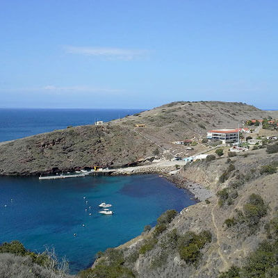
Students in the M.S. in GIST, M.S. in HSGI and Graduate Certificate in GIST programs will participate in a week-long fieldwork excursion...