 Join us for the Graduate GIS Programs Information Session

Top Companies Using GIS Technology
Geographic Information Science and Technology (GIST) can be used by businesses large and small for a variety of applications. Companies that use GIS technology today are those in industries ranging from supply chain management to insurance to urban planning, banking, and health – and much more.
Climbing the Charts Using GIS
When discussing top companies that use GIS technology, we need some way to qualify “top.” So, let’s focus on the companies that land among the Fortune 500 list.
Before exploring the top companies using GIS, however, it’s important to talk about GIS software and services. Esri, is one well-known GIS company, having existed for over 50 years, that has risen to the top of the field. Esri has remained a dominant player in the GIS market, with a 32% share, according to a 2025 report from Fortune Business Insights. Its technology is used by hundreds of thousands of organizations and 50% of Fortune 500 companies.
“Today, our technology is not simply a tool but is being embraced as an enterprise platform by literally thousands of large companies like utilities, whole cities, whole agencies,” as Esri founder Jack Dangermond said in a recent interview.
Request Brochure
Fill out the information below to learn more about the University of Southern California’s GIS Graduate Programs and download a free brochure. If you have any additional questions, please call 213-325-2474 to speak to an enrollment specialist.
Companies Using GIS: The Obvious
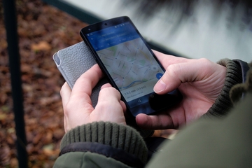
Technology companies such as Apple, Microsoft, and Alphabet (Google’s parent company) are all companies that use GIS. And, any smartphone user who checks weather radar or uses Google Maps is a GIS user themselves. In fact, mobile technology and the “app revolution,” as Dangermond calls it, is a major driver of the rising number of organizations that use GIS.
Online retail giant Amazon is another prominent GIS-centric company, making use of the technology to devise offerings and marketing campaigns that meet the unique needs of customer groups around the world. And of course, it’s easy to imagine how telecommunications companies like AT&T and Verizon might use GIS to better serve their customer bases — such as by identifying locations where new cell towers or better communications infrastructure may be needed — as well as expand into new geographies that may be underrepresented when it comes to Internet and cellular connectivity.
Insurance companies like UnitedHealth Group, Anthem, Express Scripts Holding, and State Farm Insurance Cos. – all of which are in the top 40 of the Fortune 500 – are using GIS to predict risk and help determine premiums. For example, a customer who lives in an area that is more prone to earthquakes or perhaps has a greater propensity toward crime, would land in a higher risk group and pay premiums accordingly. Conversely, a customer living in a low-crime area with minimal risk from natural disasters could benefit from lower rates.
Companies Using GIS: The Not-So-Obvious
While you might not necessarily think of Walmart as a GIS company, anytime the multi-hundred-billion-dollar company wants to expand into a new area, it overlays spatial information with its other market research to determine optimal locations for placing a store or buying land.
Walmart is also using GIS and geospatial technology to optimize its delivery network and expand service to more households. By combining spatial intelligence with internal and external data, Walmart maps geographic areas using a granular hexagonal grid rather than relying on broad (and often arbitrary) boundaries such as ZIP codes. This allows the company to customize delivery catchment areas for individual stores, understand local customer needs and decide where and how to provide delivery services with more precision.
And really, any business can derive the same benefits from using GIS, helping them remain competitive with other top companies. When businesses like Home Depot or Johnson & Johnson expand into a new area, using GIS becomes a necessity for maximizing their investments.
Using GIS: The ‘Geographic Advantage’
More and more organizations are leveraging GIS as mapping and location analytics become democratized. In particular, one of the biggest growth areas for GIS applications is in the global transportation analytics sector, which Spherical Insights projects to grow from $13.6 billion in 2023 to $54.9 billion by 2033.
“Data-driven analytic mapping is providing a new language that’s quickly understood by everyone, across organizations and around the world. What’s exciting to me today is this type of mapping in organizations is just beginning to be understood and embraced. We are at the threshold of better geographic understanding,” Esri’s Dangermond said.
With the evolution of trends like the Internet of Things (IoT), there will be even more spatial data to leverage. As a result, there will be few businesses left in the coming years that aren’t using GIS. Regardless of whether we’re talking small or large retailers, transportation, logistics optimization, wholesalers, or supply chain logistics, to remain competitive, almost any business must become a GIS company.
About USC’s GIS Graduate Programs
The University of Southern California offers a comprehensive selection of GIS programs. This includes both residential and online GIS master’s degrees, as well as residential and online GIS graduate certificates. Click on the programs below to learn about our leading geographic information science education.
GIS Master’s Degrees
- Master of Science in Geographic Information Science and Technology (GIST) – Online and Residential
- Master’s in Geodesign, Environment and Health – Residential
- Master of Science in Human Security and Geospatial Intelligence – Online and Residential
- Master of Science in Spatial Data Science – Online and Residential
- Master of Science in Spatial Economics and Data Analysis – Online and Residential
- Master of Arts in Global Security Studies – Residential
GIS Graduate Certificates
- Graduate Certificate in Geographic Information Science and Technology (GIST) – Online and Residential
- Graduate Certificate in Geospatial Intelligence – Online and Residential
- Graduate Certificate in Geospatial Leadership – Online and Residential
- Graduate Certificate in Remote Sensing for Earth Observation – Online and Residential
Ready to take the next step?
Start your application.
Ready to deepen your expertise in geospatial technologies and expand your career opportunities?
Learn more about USC’s GIS programs.
Catalina Island Excursion

Students in the M.S. in GIST, M.S. in HSGI and Graduate Certificate in GIST programs will participate in a week-long fieldwork excursion...