GIST in the Military: This Air Force Veteran Took Her Career to New Heights
We’re celebrating our student and alumni veterans by sharing stories about their geospatial work in the military and experiences in the GIST programs.
María Leasure is an Air Force veteran, currently employed as a geospatial analyst at Crisis24, an integrated risk management company. She graduated from the USC Graduate Certificate in Geographic Information Science and Technology (GIST) in 2018, and the Master of Science in GIST in 2021. Below, Leasure details her favorite projects in the programs, including the Catalina Island fieldwork excursion, and her exciting professional work with GIS.
Read our other recent Q&A with Army veteran and current M.S. in GIST student Kurtis Eisenhuth.
View our previous military student and alumni Q&As.
Request Brochure
Fill out the information below to learn more about the University of Southern California’s GIS Graduate Programs and download a free brochure. If you have any additional questions, please call 213-325-2474 to speak to an enrollment specialist.
How did you get involved with geospatial work in the military?
Spatial awareness has always been essential in the military. In the Air Force, I served in an intelligence role, and being able to read maps and use GIS tools at some level was expected. Later, I was able to delve into spatial analysis techniques as part of a focused work group and became really interested in learning more.
How do you use GIS in your current role?
My team provides mapping support for risk and security analysts, both by curating suitable spatial data and by creating cartographic products. We are also working on a project, for use by all kinds of travelers, to outline areas where there are risks not necessarily present in the wider region. For example, we might outline an area in a country where there are unexploded land mines to alert members of a client NGO who may work or drive in remote places.
Why did you select the University of Southern California to complete the GIST programs?
There were many reasons. Of course, USC has a strong faculty and a reputation for high academic standards, so that first drew me to the university. I loved that there was so much flexibility in campus locations, online options and course offerings in all semesters, which really helps students continue their professional work or research interests while working toward the degree. The field work component on Catalina was also a major factor.
What was the online experience like for you?
I liked that the core courses helped everyone get used to the online environment. I have to work asynchronously in my workplace, and I appreciate that it can be difficult for many people to feel engaged and communicate well if they are not used to it. USC created opportunities early on to establish connections to classmates.
How were your experiences with faculty, staff and fellow students?
I learned so much from the wide variety of backgrounds; this was a huge plus of the programs. It was a very supportive environment and everyone had a strong work ethic. That was important in group projects and peer reviews, which were always good experiences for me.
How have the programs benefited you?
Being exposed to different data integration and collection tools that I would not have known about without my coursework has been extremely valuable. Drone work and the FME (Feature Manipulation Engine) toolbox are a couple of specific examples.
Learning about the different ways that GIS is used in various fields and organizations has helped me think more creatively about problem-solving. I have learned to organize, communicate and collaborate so much more effectively.
What knowledge and skills did you acquire that you find especially valuable?
It sounds funny, but I feel like I have finally learned how to learn – that is, to identify knowledge gaps and find a way to address them. I have a lot of confidence now in my ability to teach myself a new skill, and then to share that with others. I also feel like I can acknowledge major obstacles and work around them. We can’t always immediately solve problems, but we can still find a way forward.
What was one of your favorite GIST projects?
My committee managed to make my geodatabase thesis fun. It was still a lot of stress and work – I will not lie. But it was a great opportunity to explore a special interest of mine – archaeology and our earliest history – and to be so encouraged and challenged.
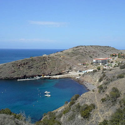
The field research on Catalina, where we did a study on favorable environments for one of the cacti on the island, will also always be a favorite because of the close teamwork and awesome environment to explore a real-world question together. The Pacific coast is beautiful beyond words.
About USC’s GIS Graduate Programs
The University of Southern California offers a comprehensive selection of online and residential GIS programs. This includes both GIS master’s degrees and GIS graduate certificates. Click on the programs below to learn about our leading geographic information science education.
GIS Master’s Degrees
- Master of Science in Geographic Information Science and Technology (GIST) – Online and Residential
- Master’s in Geodesign, Environment and Health – Residential
- Master of Science in Human Security and Geospatial Intelligence – Online and Residential
- Master of Science in Spatial Data Science – Online and Residential
- Master of Science in Spatial Economics and Data Analysis – Online and Residential
- Master of Arts in Global Security Studies – Residential
GIS Graduate Certificates
- Graduate Certificate in Geographic Information Science and Technology (GIST) – Online and Residential
- Graduate Certificate in Geospatial Intelligence – Online and Residential
- Graduate Certificate in Geospatial Leadership – Online and Residential
- Graduate Certificate in Remote Sensing for Earth Observation – Online and Residential


