Geographic Information Science and Technology in the Intelligence Community
In the era of big data, few industries have experienced as much growth as those that take advantage of geospatial data. In fact, the United Nations Global Geospatial Information Management project estimates that 2.5 quintillion bytes of data are created daily, and that a “significant amount” is location-aware.
The proliferation of devices that make it accessible is just as important as the growth of the creation of location-aware data. Satellites, Smartphones, and other GIS technologies allow for more detailed and responsive applications of the data and the data is updated in nearly real-time throughout the day, every day.
Request Brochure
Fill out the information below to learn more about the University of Southern California’s GIS Graduate Programs and download a free brochure. If you have any additional questions, please call 877-650-9054 to speak to an enrollment advisor.
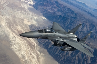
GIS In Intelligence
When private businesses think about big data, it is usually in ways that it can help their business operations; sales figures and trends, inventory tracking, operations monitoring, and customer relationship management. However, governments and the intelligence community have very different applications of geospatial data, and they have been incorporating it into their operations for some time.
For example, where sensors were previously used to canvass an area to help locate targets in hiding, the defense and intelligence community can now use data from commercial providers to track trends and detect patterns in general locations. They can then use their resources to identify activities in specific locations, resulting in more economic and efficient operations.
GIS and the Defense Community
Another way that the defense community is using GIS data is in the assessment of damages to battle areas. Analysts can explore many images to determine the effectiveness (or lack thereof) of a strike, but can be limited by the wait for aerial photos depending on weather conditions, haze, or post-strike conditions. But in the near future, it’s estimated that analysts will have access to dozens of different close-range photos of the target area within a 12-hour period.
Geospatial Intelligence
The unique mix of technology, data, and analytics that is used in the decision making processes in the defense, intelligence, security, and humanitarian fields is known as geospatial intelligence, and the U.S. Geospatial Intelligence Foundation has become a leader in advocating for geospatial intelligence as the career most equipped to address the challenges of these industries. Going beyond data analysis and technology use, geospatial intelligence applies established principles, tools, and techniques to analyze the changing patterns of human activity to solve real-world problems. The goal is to better predict future outcomes and location-based decisions.
The Geographic Information Science and Technology degree program at the University of Southern California can serve as a foundation for a career in geospatial intelligence. The comprehensive program marries a world class scientific education with advanced GIS technologies that are directly applicable to the forward-thinking industries of tomorrow. As the need for geospatial technologies increase, so too does the need for professionals with advanced GIS knowledge.
About USC’s GIS Graduate Programs
The University of Southern California offers a comprehensive selection of GIS programs, including GIS master’s degrees and GIS graduate certificates. Click on the programs below to learn about our leading geographic information science education.
GIS Master’s Degrees
- Master of Science in Geographic Information Science and Technology
- Master of Science in Human Security and Geospatial Intelligence
- Master of Science in Spatial Data Science
- Master of Science in Spatial Economics and Data Analysis
- Master of Arts in Global Security Studies
GIS Graduate Certificates
Catalina Island Excursion

Students in the M.S. in GIST, M.S. in HSGI and Graduate Certificate in GIST programs will participate in a week-long fieldwork excursion...