
I have a lot of experience with online degree programs, and I’ve found that USC’s is legitimately a cut above the rest.
Eli Ibanga, M.S. in HSGI, Class of 2018

USC and the GIST program at the Spatial Sciences Institute have changed my life. The coursework was intellectually stimulating and challenging, and gave me the flexibility and skill set required to pursue a real-world thesis project.
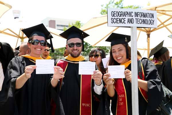
Trevor Denson, M.S. in GIST, Class of 2017
Wilderness Ranger, National Park Service

A month before defending my thesis for the USC GIST program, I was offered the position of geographic analyst with Nokia’s HERE Maps. A large part of my job is field data collection: finding sources for new and updated map content and ensuring their accurate, real-world representation within the database. In our multi-camera, GPS-receiving vehicles, I’m on a mini-road trip every week.
Emily Frazier, M.S. in GIST
Geographic Analyst II at HERE TECHNOLOGIES
USC's GIS degree and certificate programs are taught by world-renowned faculty with spatial science backgrounds spanning environmental science, business analytics, geography and countless other industry domains. With the full support of one of the leading GIS research institutions, connections to industry experts and extensive multidisciplinary expertise, our GIS master’s degree and graduate-level GIS certification programs offer a combination of comprehensive and program flexibility that few other academic institutions are capable of delivering.
Watch this video to find out how a USC GIS master’s degree or graduate certificate can transform the way you look at the world:
This video was created in 2019 and may contain out-of-date information.
Our GIS courses combine geography and intelligence principles with extensive hands-on experience using the latest technologies, leveraging the best GIS, GPS and remote sensing software to work with spatial data in a real-world context. GIS program graduates will be able to go beyond basic analysis of geographic information systems data; they will be adept at developing solutions for complex problems of the world.
Learn more about our GIS graduate programs
With nine GIS programs at the graduate level, including five GIS master's degrees and four GIS certificate programs, you can map out the best path for your career needs, whether you're only starting the journey into a GIS career or you're an experienced GIS professional interested in senior positions. We are committed to ensuring our programs are accessible to all, including those who work full time, live outside the U.S. or manage an unpredictable schedule. With the support of a state-of-the-art course delivery platform, we offer two program modality options and flexible class formats for online learners.
At USC, we don’t let convenience come at the cost of peer relationships. As a GIS student, you’ll discover new avenues to form a collaborative, supportive network of peers in your industry, whether it’s participating in livestreamed classes, posting on discussion boards and virtual chats or performing fieldwork in person.
Master’s in Geographic Information Science and Technology
(Available online and residential)
The M.S. in GIST is designed for professionals interested in using spatial data to solve complex challenges in fields ranging from public safety to supply chain logistics and more.
Learn more about this GIS Master’s Degree
Master’s in Global Security Studies
(Available residential)
The M.A. in Global Security Studies provides students with expert-level knowledge in global security studies so that they are prepared to address complex challenges such as environmental vulnerability, public health, food and resource scarcity, regional conflict, cyber attacks and other natural and human-caused instability issues.
Learn more about this GIS Master’s Degree
Master’s in Human Security and Geospatial Intelligence
(Available online and residential)
The M.S. in Human Security and Geospatial Intelligence is designed for professionals with an interest in leveraging spatial and temporal data to prepare for and respond to numerous types of incidents, such as natural disasters and terrorist attacks. Graduates will be prepared for senior-level and managerial roles within the geospatial and human security fields.
Learn more about this GIS Master’s Degree
Master’s in Spatial Data Science
(Available online and residential)
The M.S. in Spatial Data Science is designed for professionals who are interested in connecting data science and spatial science. In this spatial data science master’s program, students will learn how to apply data science techniques to spatial data as a means of solving spatial problems in a variety of areas, including urban planning, business and agricultural management.
Learn more about this GIS Master’s Degree
Master’s in Spatial Economics and Data Analysis
(Available online and residential*)
The M.S. in Spatial Economics and Data Analysis is designed for professionals who are interested in the intersection of applied economics, data science and spatial science. Graduates of the program will develop an in-depth understanding of the fundamentals of spatial economics and the ability to apply spatial analysis and spatial modeling approaches to business opportunities and policy solutions addressing urban problems.
Learn more about this GIS Master’s Degree
Graduate Certificate in Geographic Information Science and Technology
(Available online and residential*)
The graduate certificate in geographic information science and technology is ideal for professionals who want to enhance their skill sets with specific knowledge or for individuals who are just starting to consider GIS careers. The coursework provides foundational knowledge, including an understanding of geospatial databases and spatial data acquisition techniques, while elective choice enables students to gain some experience with advanced GIS concepts and tools.
Learn more about this GIS Certificate
Graduate Certificate in Geospatial Intelligence
(Available online and residential*)
The graduate certificate in geospatial intelligence provides a foundation for leveraging spatial data in conjunction with social, political and environmental information to make decisions. It is designed for individuals who want to use spatial data to create actionable insight in disaster planning and incident response.
Learn more about this GIS Certificate
Graduate Certificate in Geospatial Leadership
(Available online and residential*)
The Graduate Certificate in Geospatial Leadership is available for professionals in the geospatial industry to hone their technical skills while also learning leadership strategies for the GIS field. The coursework focuses on strategies for encouraging innovation and shaping the direction of GIS initiatives and organizations.
Learn more about this GIS Certificate
Graduate Certificate in Remote Sensing for Earth Observation
(Available online and residential*)
The Graduate Certificate in Remote Sensing for Earth Observation explores the principles of spatial data acquisition through a variety of systems and sources. This program can benefit both experienced GIS professionals and newcomers to the field with coursework in gathering information through traditional systems, such as imaging radar and satellites, and from emerging innovative sources, such as mobile devices and text-scraping.
Learn more about this GIS Certificate
*The application for the residential graduate certificates and online M.S. in Spatial Economics and Data Analysis (SEDA) program will open in early August.

The University of Southern California (USC) is one of the world’s leading private research universities. Established in 1880, it is also one of the oldest. With a strong tradition of integrating liberal arts and sciences with professional education, USC fosters a vibrant culture of public service and encourages students to cross academic and geographic boundaries in their pursuit of knowledge.
- Ranked among the Top 30 national universities by U.S. News & World Report 2024
- Ranked among the Top 15 best colleges for veterans by U.S. News & World Report 2024
USC Spatial Sciences Institute is a founding member of the UNIGIS International Association, which recognizes international standards in geographic information science distance learning programs.
USC Dornsife Spatial Sciences Institute
The ability to understand and make decisions with spatial information is what the USC Dornsife Spatial Sciences Institute is all about. We partner with researchers, businesses, nonprofits, NGOs and other entities to analyze, model and visualize location-based data. As a leading GIS research and academic institute, we have the unique ability to attract talented researchers and educators from a wide range of disciplines and promote collaboration across countless areas of expertise and industry domains.
The Spatial Sciences Institute has received recognition from numerous organizations within the GIS industry, including:
- The Spatial Sciences Institute was the first educational institution member of the Urban and Regional Information Systems Association, which supports GIS professionals within their organizations.
- The Spatial Sciences Institute is a member of the U.S. Geospatial Intelligence Foundation, which has accredited the USC Graduate Certificate in Geospatial Intelligence.
- The Spatial Sciences Institute is an Esri Education Development Center, which encourages students to pursue projects and careers focused on GIS technology development and customization.
Learn more about our GIS graduate programs
Ranked among the Top 30 National Universities and among the Top 15 Best Universities for Veterans (U.S. News & World Report, 2024)
Accredited by the Western Association of Schools and Colleges Senior College and University Commission (WSCUC)
Member of the UNIGIS International Association
The M.S. in Human Security and Geospatial Intelligence and Graduate Certificate in Geospatial Intelligence are accredited by the United States Geospatial Intelligence Foundation (USGIF)
Funding Assistance Available for Eligible Active Military and Veterans through the Yellow Ribbon Program. Contact an Enrollment Advisor for Details.
The Office for the Director of National Intelligence has designated the University of Southern California as an Intelligence Community Center for Academic Excellence (IC CAE).